
Surface area 1.7 km (0.66 sq mi) | Surface elevation 4,300 m (14,100 ft) | |
 | ||
Location | ||
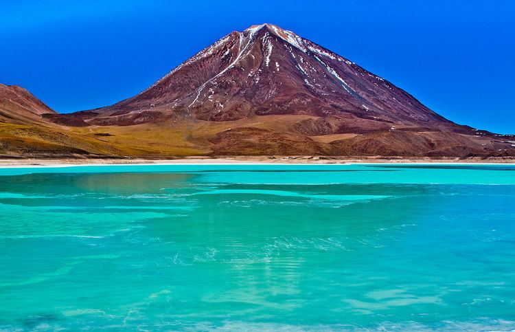
Laguna Verde (Spanish for "green lake") is a salt lake in and endorheic basin, in the southwestern Altiplano in Bolivia. It is located in the Sur Lípez Province of the Potosí Department. It is close to the Chilean border, at the foot of the volcano Licancabur.
Contents
Map of Laguna Verde, Bolivia
Geography
The Laguna Verde covers an area of 1700 ha, and a narrow causeway divides it into two parts. It is at the southwestern extremity of the Eduardo Avaroa Andean Fauna National Reserve and Bolivia itself. It has mineral suspensions of arsenic and other minerals which renders colour to the lake waters. Its color varies from turquoise to dark emerald depending on the disturbance caused to sediments in the lake by winds.
In the backdrop of the lake there is the inactive volcano Licancabur of 5,868 metres (19,252 ft) in elevation, which is a nearly perfect cone. It is believed that an ancient crypt used to be at its peak.
Icy winds are a common phenomenon here and lake waters can attain temperatures as low as -56 degree C but because of its chemical composition its waters still remain in a liquid state. It is 30 km far from Palques Lake .
The Laguna Verde is known for its spectacular scenery and hot springs. Visitors may see flamingoes 'dancing' in the saltwater.