
Time zone BRT (UTC-3) Local time Saturday 2:36 AM | Elevation 464 m (1,522 ft) Area 233.2 km² | |
 | ||
Weather 21°C, Wind SW at 5 km/h, 86% Humidity | ||
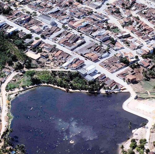
Lagoa dos Gatos is a municipality in the state of Pernambuco, Brazil.
Contents
- Map of Lagoa dos Gatos State of Pernambuco Brazil
- History
- Geography
- Economy
- Economic Indicators
- References
Map of Lagoa dos Gatos - State of Pernambuco, Brazil
History
Portuguese explorers first reached the place in the late 18th century, and it is presumed that José Cavalcanti Fragoso was the one to establish the settlement of Peri-Peri, which would later become the town. Lagoa dos Gatos was officially recognised as a populational gathering in 1832 and became a village in 1839. In 1928 it became a was renamed Frei Caneca, until 1938, when it reverted to its original name.
Local legends state that the name, which literally means "Cat's Lagoon", was used by its first explorers after sighting a few margays at a small lagoon.
In 1832 the mountainous surroundings of Lagoa dos Gatos played an important role at the "Guerra dos Cabanos" (War of Cabanos), one of the many uprisings in Brasil's first years of independence.
Geography
Economy
The main economic activities in Lagoa dos Gatos are based in agribusiness, especially manioc, sugarcane and creation of cattle and goats.
Economic Indicators
Economy by Sector 2006