Kalpana Kalpana (Editor)

Cupira, Pernambuco

Updated on
Edit
Like
Comment
Share on FacebookTweet on TwitterShare on LinkedInShare on Reddit
Area
  
106 km²

Cupira, Pernambuco httpsiytimgcomvivRFtqBo2Vqghqdefaultjpg

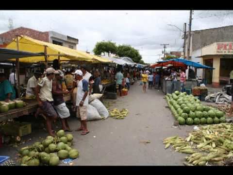
Cupira (population 22.783) is a city in northeastern Brazil, in the State of Pernambuco. It lies in the mesoregion of Agreste of Pernambuco and has 105.92 sq/km of total area.

Contents

Map of Cupira - State of Pernambuco, Brazil

Geography

  • State - Pernambuco
  • Region - Agreste of Pernambuco
  • Boundaries - Agrestina, Altinho and São Joaquim do Monte (N); Lagoa dos Gatos (S); Belém de Maria (E); Panelas (W).
  • Area - 105.92 km2
  • Elevation - 416 m
  • Hidrography - Una river
  • Vegetation - Subcaducifólia forest
  • Annual average temperature - 23.4 c
  • Distance to Recife - 170.5 km
  • Economy

    The main economic activities in Cupira are related with commerce and agribusiness, especially creations of cattle, goats, sheeps, pigs; and plantations of sweet potatoes, beans and manioc.

    Economic indicators

    Economy by sector
    2006

    References

    Cupira, Pernambuco Wikipedia