
Surface elevation 2,400 m | ||
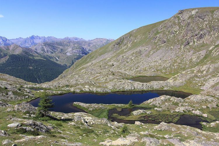 | ||
The lacs Les Laussets are a group of three lakes in the Tinée valley, Alpes-Maritimes, Alps, France. They are located at an elevation of 2400 m, south-east to the Crête des Terres Rouges, and close to the Tête des Mourres.
Contents
- Map of Les Laussets 06660 Saint C389tienne de TinC3A9e France
- Itinerary
- From the Hameau du Pra
- From the Camp des Fourches
- References
Map of Les Laussets, 06660 Saint-%C3%89tienne-de-Tin%C3%A9e, France
Of note, a group of lakes can be found in the vicinity of the lakes Les Laussets: the lakes of Morgon.
Itinerary
On the way of the Col de la Bonette from the Saint-Étienne-de-Tinée side, two main itineraries are possible.
From the Hameau du Pra
From the hamlet of Pra, follow the trail that goes up in the south-facing slope, and reach the small plateau of Morgon. Quit the marked route leading to the forest house of Tortisse, and climb in the valley of Morgon, find a pastoral hut and then walk through a scree slope. On the left, climb the rocky spine to find a secondary valley. Follow the small torrent and then reach the lakes Laussets.
From the Camp des Fourches
From the Camp des Fourches, go to the Col des Fourches. Follow the GR 5 to go down in the Cougnas ravine. Leave the GR at tag 37 (2100 m), cross a ravine, and follow on the right the small footpath in the Cabane valley, along the Salso Moreno torrent. Enter a small rocky gorge on the right, and find the Big Lake of Morgon. From there, walk west to reach the three lakes Les Laussets.