
District 1st district Barangays Area 589.4 km² Local time Saturday 12:45 AM | Founded September 8, 1800 Time zone PST (UTC+8) | |
 | ||
Weather 24°C, Wind N at 5 km/h, 86% Humidity Neighborhoods Abuyog, Kanapauan, Masolong, Bagong Silang, Bagacay | ||
Labo is a first class municipality in the province of Camarines Norte, Philippines. According to the 2015 census, it has a population of 101,082 people.
Contents
- Map of Labo Camarines Norte Philippines
- Florante at laura labo camarines norte
- Geography
- Climate
- Barangays
- Demographics
- Economy
- Culture tradition and folklore
- Attractions
- References
Map of Labo, Camarines Norte, Philippines
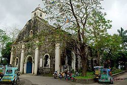
Florante at laura labo camarines norte
Geography
The town of Labo is geographically located relatively at the center of the province of Camarines Norte. It is approximately 335 kilometers south of Manila and 15 kilometers away from Daet, the capital town of the province. It is situated at the coordinates between 14°01'06" and 14°11" North latitudes and 122°21'00" and 122°52'20" East longitudes. On the North, it is bounded by the municipalities of Paracale, Jose Panganiban, and Capalonga, on the South, by the province of Quezon, adjoining province of Camarines Sur, on the East by the municipalities of Vinzons and San Vicente, and on the West by the municipality of Sta. Elena. The Maharlika highway links this municipality to provinces and cities of the Bicol Region and the Calabarzon (Region IV-A) region.
Its aggregate land area of 648.84 km² occupies more than 25% of the total land area of the province. Its 52 component barangays represent 18.44% of the total barangays of the province. There are ten (10) classified as urban barangays namely Bagacay, Cabusay, Fundado, Anahaw, Bagong Silang I, Dalas, Gumamela, Kalamunding, Malasugui, Pinya, San Francisco, Talobatib and Tulay na Lupa, and the remaining forty two are considered as rural.
The surface of the municipality is generally rugged, rolling hills and mountainous terrain with relative small rollings and flat terrain. Mt. Cadig (736 m above sea level), Mt. Labo(943 m above sea level), Mt. Bagacay (786 m above sea level) and Mt. Nalisbitan (265 m above sea level) form the Southern Cordillera. Boundaries of Camarines Norte, Camarines Sur, and Quezon provinces converge on Mt. Labo, which is the highest peak in the province. Mt. Bagacay serves as a boundary between municipalities of Paracale and Labo and it as well guards the municipality from strong north winds especially during typhoons. Mt. Labo, Mt. Bagacay, and Mt. Cadig are the three major known dormant volcanoes in the municipality. The north-west portion of the municipality is greatly affected by 2 major fault and earthquake lines accruing in the province, while other trends affect north-north-west along Mt. Cadig passing through the barangays of Guisican and Bayabas. Like its neighbors, Panganiban and Paracale, there is a vast deposit of gold ore in the mountains of Labo, Camarines Norte. It is believed that Mt. Bagacay hides the treasures of Gen. Yamashita and is the target of both local and foreign treasure hunters and bounty seekers.
Climate
There is no pronounced dry season and maximum rain period from December to January.
Barangays
Labo is politically subdivided into 52 barangays.
Demographics
In the 2015 census, the population of Labo, Camarines Norte, was 101,082 people, with a density of 170 inhabitants per square kilometre or 440 inhabitants per square mile.
Economy
Labo being located at the center of the province and the most populous town serves as the agricultural center as well as potential investment destination and promotion center for business, trades, and secondary industrial growth center. It is abundant with natural resources such as gold, nickel, iron, magnetite sand, copper, lead and manganese. Most of the provincial water supplies are located at barangay Tulay na Lupa and Lugui which serves seven out of the 12 municipalities. Agriculture is the leading livelihood of the residents of Labo. Due to abundant forest products such as rattan and bamboo, local folks tend to manufacture and market handicrafts.
An area of 390.39 km² (65.17% of municipal's land area) is devoted to agricultural crop production, 343.46 km² of which are coconut plantations. On the other hand, 18.47 km² is used for rice production. Banana production is also popular in the province, followed by Pineapple and Pili.
Tourism is also a good source of income for Labo, being surrounded by freshwater and mountains suitable for hikings.
Other community livelihood follows: pineapple and coco-based processing and preservation, pineapple weaving (Barong), jewelry making and accessories, foods manufacturing and beverages processing, other tourism related industries and wood and bamboo furniture making.
Culture, tradition and folklore
These traditions and beliefs are still widely practiced. Despite the growth of modern technologies, almost everybody still believes in luck.