
Season Year-round | Trail difficulty High Length 78,000 m | |
 | ||
Trailheads George Lake (park office) Highest point Silver Peak east lookout, 539 m (1,768 ft) Lowest point Baie Fine, 177 m (581 ft) Uses Hiking, Snowshoe, Cross-country skiing | ||
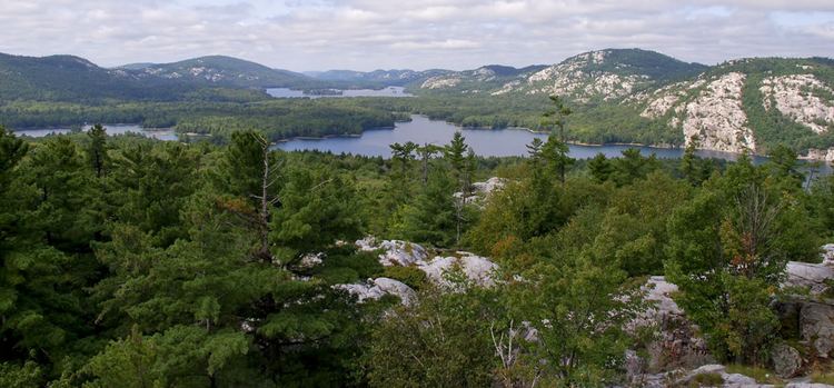
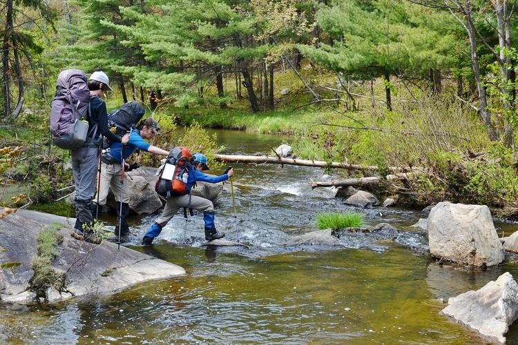
Killarney provincial park 1 la cloche silhouette trail solo in 3 days
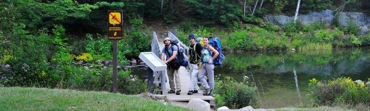
The La Cloche Silhouette Trail is a 78-kilometre (48 mi) backpacking loop across the rugged quartzite peaks of the La Cloche mountain range. The trail is situated in Killarney Provincial Park, Ontario, Canada. The trail is named for Group of Seven painter Franklin Carmichael's painting "La Cloche Silhouette." Wildlife can be seen throughout the trail - black bears, moose, deer, snakes, turtles, and beavers, among other animals, can be seen at various points along the way.
Contents
- Killarney provincial park 1 la cloche silhouette trail solo in 3 days
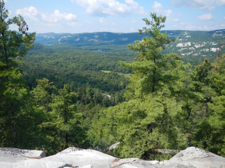
- La cloche silhouette trail autumn 2015
- Baie Fine
- Threenarrows
- Hansen Township
- Silver Peak
- Killarney Ridge
- References
The trail itself is divided into five sections, individually listed below.
La cloche silhouette trail autumn 2015
Baie Fine
The Baie Fine section runs for 14 kilometres, and is known for its gentle rolling hills, hardwood forests, beaver dams, and pink granite. It begins at the trailhead - a large, informative sign detailing the history of the trail. The forest comprises red and yellow birch, red maple, white pines, and black spruce. The terrain is, for the most part, flat, with a few steep pitches and creek crossings along the way. It concludes with a steep portage up an old logging road that leads to Threenarrows Lake. Local legend has it that the area was once a summer getaway for notorious gangster Al Capone.
Threenarrows
The Threenarrows section is 19 kilometres long, and is named for the sprawling dammed lake that it traces. The trail occasionally runs through cedar forests along the banks of Kirk Creek, but for the most part follows the shoreline of Threenarrows lake as it ascends north into the La Cloche Mountains. The section is a particularly good place to look for wildlife; the low-lying deciduous forests are the perfect hideout for deer, moose, and Ruffed Grouse.
Hansen Township
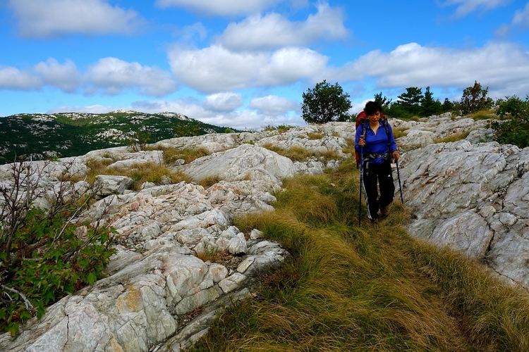
The Hansen Township section, at 15 kilometres, has some of the most consistently difficult terrain on the trail, winding its way through the heart of the La Cloche Mountains. It was the last section to be completed, and was finished in 1987, making the trail a complete loop. The steep climbs and challenging descents are well worth the views of the park below - the stark white mountains and acid blue lakes that litter the section are difficult to reach, but are also some of the most beautiful places in the park. The section takes hikers from the main La Cloche mountain range to lower-lying deciduous forests, and was named for Canadian paraplegic athlete Rick Hansen.
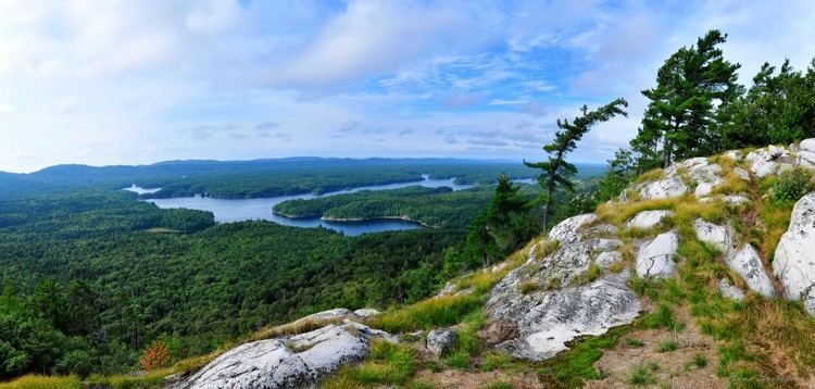
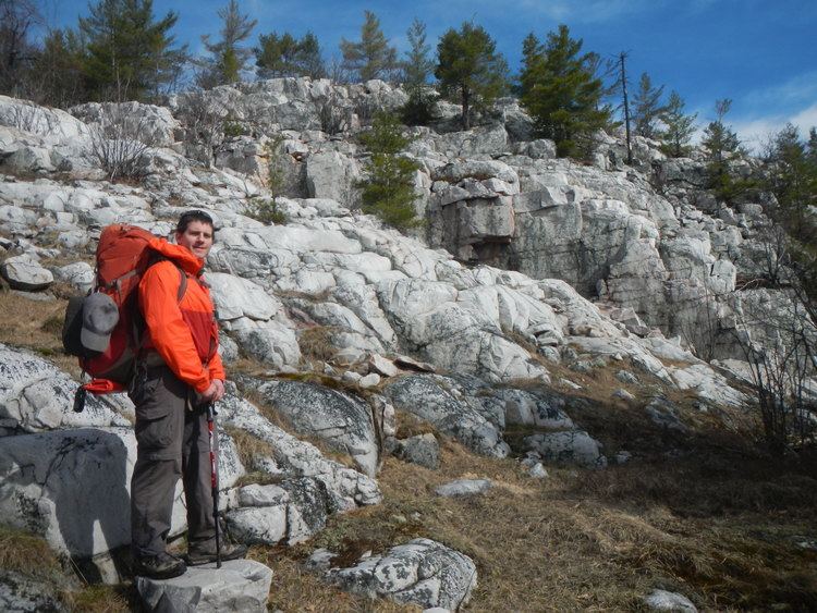
Silver Peak
The Silver Peak section is 16 kilometres long, and includes the difficult side trail leading to Silver Peak, the highest point in the entire park. It is one of the more well-travelled sections of the trail, intersecting with portages and day hike trails as it winds its way into the Killarney ridge, the southern section of the La Cloche mountains. As it ascends into the mountains, the rocks once more turn to exposed quartzite and the lakes regain their bright blue colouring.
Killarney Ridge
The final piece of the trail, assuming clockwise travel, is the Killarney ridge section, at 8 kilometres. The terrain is varied, from rocky ridges and coniferous trees to swamps, and hardwood forests. The stark changes are made possible by a steep descent through "The Crack," an enormous chasm that hikers must carefully navigate in order to leave the mountains. The trail ends where it began, on the picturesque, granite shores of George Lake.