
Peak Raitelberg Length 25.752 km (16.002 mi) | Elevation 561.0 m (1,840.6 ft) Orogeny Bergland | |
 | ||
State Baden-Württemberg, Deutschland | ||
The Löwenstein Hills (German: Löwensteiner Berge) are a hill range up to 561 m above sea level (NHN), in the counties of Heilbronn, Ludwigsburg, Rems-Murr-Kreis and Hohenlohekreis in the German state of Baden-Württemberg. They are named after the town of Löwenstein.
Contents
- Map of Lowensteiner Berge 74245 LC3B6wenstein Germany
- LocationEdit
- HillsEdit
- Rivers and streamsEdit
- GeologyEdit
- LiteratureEdit
- References
Map of Lowensteiner Berge, 74245 L%C3%B6wenstein, Germany
LocationEdit
According to the classification of the Handbook of Natural Region Divisions of Germany, the Löwenstein Hills are natural region number 108.1 in the Swabian-Franconian Forest in the Swabian Keuper-Lias Plains. Most of the range belongs to the Swabian-Franconian Forest Nature Park.
The forested hill country lies around 40 kilometres north-northeast of Stuttgart and about 20 kilometres east-southeast of Heilbronn between the Hohenlohe Plain to the north, the Mainhardt Forest to the northeast, the Murrhardt Forest to the southeast, the Backnang Bay to the south and the Neckar Basin to the west.
The Heilbronn Hills and the Sulm Plateau continue the Löwenstein Hills to the northwest and, in the Heilbronn Hills to the south reach as far as Weinsberg and Heilbronn and in the Sulm Plateau to the north reach as far as Bretzfeld, Eberstadt, Langenbrettach, Erlenbach and Neckarsulm.
On the northern edge of the range are the settlements of Löwenstein and Obersulm, to the east are Wüstenrot and Spiegelberg, to the south, Sulzbach an der Murr, Oppenweiler, Backnang and Aspach, and on the western rim are Oberstenfeld, Beilstein, Abstatt, Untergruppenbach and Lehrensteinsfeld.
To the south, west and north, mighty Keuper escarpments prominently mark the boundaries of the range with the Backnang Bay, Neckar Basin and Hohenlohe Plain. The valley of the Murr between Sulzbach and Oppenweiler separates the Lowenstein Hills from the Murrhardt Forest. The boundary with the adjacent Mainhardt Forest to the east is not clear from the terrain; it runs roughly from north to south, initially following the valley of the Gabelbach, a tributary of the Brettach, then via the settlement of Chausseehaus on the Bundesstraße 39 Federal road to the watershed on the ridge between the Lauter in the west and the Fischbach in the east, which it then follows.
In the sparsely populated Lowenstein Hills themselves there are only a few small settlements.
HillsEdit
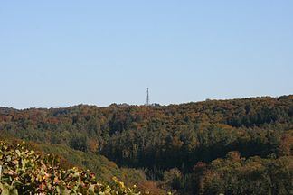
The highest point of the Löwenstein Hills, at 561 m, is the wooded Raitelberg west of Wüstenrot; roughly north of this "hill" is the Stangenberg (559 m). The forested Horkenberg between Löwenstein and Wüstenrot, at 549 m, is very high. The Stocksberg (538.9 m) which belongs to Beilstein and Löwenstein and the Juxkopf (533.1 m) near Spiegelberg with its Juxkopf Tower have good views. To the west in the Heilbronn forest area of the Heilbronn Hills is the Schweinsberg (372.8 m) and another observation tower, the Schweinsberg Tower, the Heilbronn Transmission Tower (Fernmeldeturm Heilbronn) and the Schweinsberg Water Tower (Hochbehälter Schweinsberg) owned by the Lake Constance water company, Bodensee-Wasserversorgung.
To the south where the hills transition into the Mainhardt Forest, the wooded Black Jurassic kuppen between the Lauter valley and Fischbach valley heights rise up to 565.7 m (Steinberg south of Wüstenrot).
Rivers and streamsEdit
The following rivers and larger streams drain the Lowenstein Hills or are catchment waters on its perimeter.
GeologyEdit
Geologically the Löwenstein Hills belong to the Germanic Trias supergroup of the earth's Triassic period and are counted as part of the Keuper, which means they were formed about 220 million years ago. The highest points are isolated Black Jurassic domed summits or kuppen, which lie on the Knollenmergel.
In the Löwenstein Hills there are numerous outcrops, rock formations and mining galleries, some of which have educational paths offering information about them: