Samiksha Jaiswal (Editor)

Kuttikkanam

Updated on
Edit
Like
Comment
Share on FacebookTweet on TwitterShare on LinkedInShare on Reddit
Country
  
District
  
Vehicle registration
  
KL-37

Nearest cities
  
State
  
Time zone
  
IST (UTC+5:30)

Local time
  
Sunday 2:28 PM

Kuttikkanam httpsmw2googlecommwpanoramiophotosmedium

Named for
  
Steep slopes, Valleys and hairpin roads

Weather
  
26°C, Wind W at 5 km/h, 74% Humidity

University
  
Marian College Kuttikkanam

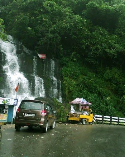
Beautiful india kerala kuttikkanam ninnumullypara waterfalls route kk road


Kuttikkanam (Malayalam: കുട്ടികാനം), is a hill station in Idukki district, Kerala, southern India. It is 3,500 feet (1,100 m) above sea level and surrounded by lush green tea plantations. It is within the territory of Peermade. Kanjirappally and Mundakkayam are the nearest towns.

Contents

Map of Kuttikkanam, Kerala 685531

History

In the 16th century the territory was under the rule of Changanacherry kings and was uninhabited. In 1756, the King of Travancore conquered Changanacherry, and brought the place under his supremacy. A Church Mission Society missionary, Henry Baker, started coffee plantations, and under the regency of Sri Moolam Thirunal these became tea plantations.

Under the British Raj in India, Kuttikkanam became an up-market resort. Since at first there was no road but only a pathway, the British started the Aerial Ropeway Ltd, Travancore state's first public limited company. The summer palace of the Travancore kings was located in Kuttikkanam.

During the British period and after, manpower was brought to Kuttikkanam from various parts of Kerala and Tamil Nadu. The descendants of these migrant workers constitute the major part of the population of Kuttikkanam.

Surrounding country

  • Peeru Hills. About 1 km distance.
  • Grampi. Commonly known as Parunthumpara, a rock sculpture about 150 ft (46 m) high and about 3,800 feet (1,200 m) above sea level.
  • Thottapura. The place where the Travancore royal family stored weapons.
  • Baker Hills (Commercially Named To Thrisangu Hills), Rolling hills with views.
  • Panchalimedu, a viewpoint, according to legend one of the many hiding places of the Pandavas and Panchali. From a pond known as Panchalikkulam the "Makarajyothi", can be seen, the divine flame lit during the pilgrimage season in Sabarimala.
  • Valanjanganam falls. A main attraction of Kuttikkanam, also known as Ninnumullippara. The waterfall is about 75 ft (23 m) in height and is usually covered in mist.
  • Nallathanni viewpoint. On the Kottayam-Kumily State Highway.
  • Artificial forest. A dense pine forest covering 100 acres (0.40 km2). Contains an estimated 30 species of birds, including rare endangered species. It is classified as a buffer zone by the Department of Forests and Wildlife, Kerala.
  • Azhutha Diversion Project. A project constructed by the Kerala government on the Azhutha river, diverting water to Idukki Reservoir through a 987 m long tunnel.
  • Educational Institutions

  • Marian International Institute of Management www.miim.ac.in
  • Marian College Kuttikkanam
  • Mar Baselios Christian College of Engineering and Technology, Kuttikanam
  • IHRD College Kuttikkanam
  • St. Pius X English School Kuttikanam
  • St. Joseph's Malayalam Lower Primary School, Kuttikanam
  • Government Model Residential School (GMRS), Kuttikanam
  • Sahyadri Institute of Ayurveda Nursing & Panchakarma
  • Mariagiri English Medium Higher Secondary School, Kuttikanam
  • Books

  • The Story of Peermade by George Thengummoottil (ISBN 9788192888606) http://www.theindia.info/Peermade/
  • References

    Kuttikkanam Wikipedia