
Local time Sunday 10:14 AM | Area 37.9 km² Population 9,484 (Dec 2014) | |
 | ||
Weather 11°C, Wind NW at 18 km/h, 48% Humidity | ||
Kunimi (国見町, Kunimi-machi) is a town located in Date District, Fukushima Prefecture, in northern Honshū, Japan. As of December 2014, the town had an estimated population of 9,484 and a population density of 250 persons per km². The total area was 37.90 km².
Contents
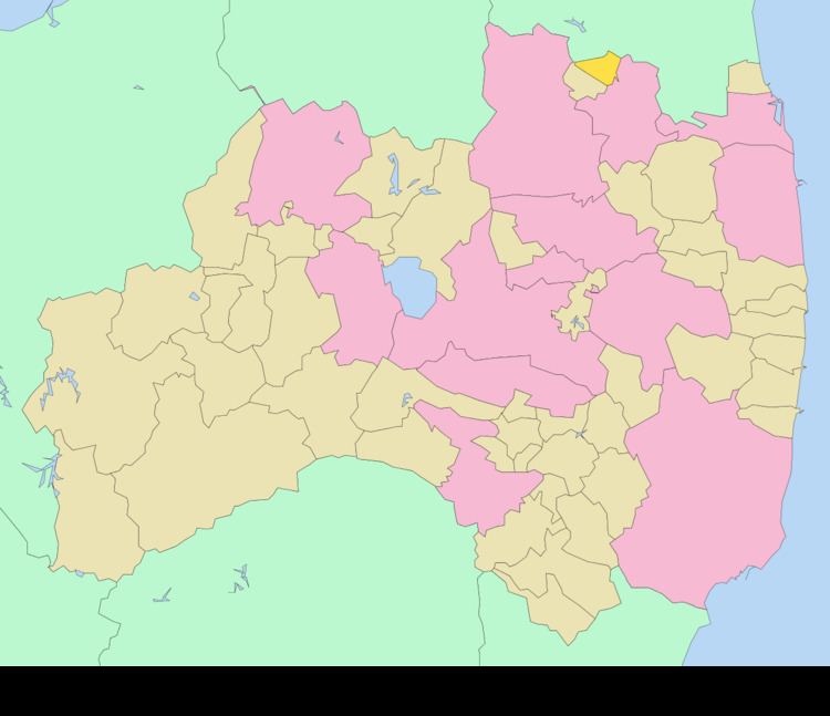
- Map of Kunimi Date District Fukushima Prefecture Japan
- Geography
- Neighboring municipalities
- History
- Economy
- Education
- Railway
- Highway
- References
Map of Kunimi, Date District, Fukushima Prefecture, Japan
Geography
Kunimi is located in the very northern portion Fukushima prefecture, bordering on Miyagi prefecture.
Neighboring municipalities
History
The area of present-day Kunimi was part of ancient Mutsu Province. After the Meiji Restoration, it was organized as part of Nakadōri region of Iwaki Province. Kunimi was formed on March 31, 1954 with the merger of the town of Fujita with the villages of Kosaka, Morieno, Okido, and Oeda, all in Date District. The town hall was destroyed in the 2011 Tōhoku earthquake.
Economy
The economy of Kunimi is primarily agricultural.