
Vehicle registration JK18 | State Jammu and Kashmir Time zone IST (UTC+5:30) | |
 | ||
Encounter in kulgam district j k 4 hizbul militants gunned down
Kulgam District (Urdu: ضلع کُلگام) is a district of the state of Jammu and Kashmir of India.
Contents
- Encounter in kulgam district j k 4 hizbul militants gunned down
- Map of Kulgam
- Administration
- Politics
- History
- Militancy
- Road facility
- Demographics
- Health facilities and education
- Habitation Environment
- Sight Seeing
- References
Map of Kulgam
Administration
Kulgam district consists of 7 blocks: Quimoh, Pahloo, D.H.Pora , Devsar, Jammu and Kashmir, Kulgam. Frisal and Behibagh. Each block consists of a number of panchayats. Population of per Blocks as: District has 7 administrative units ( Tehsils) i.e. Kulgam, D.H pora, Devsar, Frisal, Pahloo, yaripora and qaimoh. Dist. kulgam has seven important towns Frisal, Yaripora, Kulgam, Devsar, Qaimoh and D.H Pora. Five have already got municipality status but DH Pora is still get a municipality. Police dist. at Kulgam Police station at Kulgam, yaripora, qazigund and DH Pora Police posts at Mirbazar,Frisal, qaimoh, behibagh and devsar. Kulgam is divided in two sub-divisions i.e. Kulgam and D.H pora.
Politics
Kulgam District has 4 assembly constituencies: Noorabad, Kulgam, Homshailibugh and devsar. Homshallibugh j&K 39th assembly segment has three municipal towns, Frisal, Yaripora and Qaimoh.Yaripora is an education and health block, while qaimoh is agriculture as well as education and health blocks. Frisal is a CD block. Qaimoh yaripora and Frisal are tehsil headquarters as well. There are various political parties the evident political parties are Indian National Congress, PDP, National Conference & CPI(M). The MLA's of Devsar is from INC & Homshailibugh constituency are from NC, MLA of Noorabad is from PDP & MLA of Kulgam Constituency is from CPI(M).
History
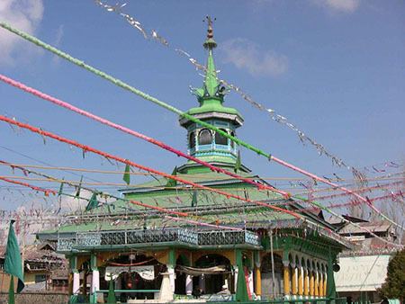
Kulgam is situated at 75° 268’ E longitude and 33°1584’ N latitude nestled in the lap of Peer Panchal Ranges overlooking the left bank of River Veshaw and has come up along a sloppy Karewa from Larow to Chawalgam. Be it the interaction with other civilizations, absorption of religious and other socio economic movements having swept sub-continent/Asia and above all the mythology associated with river Veshaw, emanating from the Kounsernag and flowing with majesty as well as ferociously depending upon the season and climatic conditions and at times resembling the prowess of mythological God/Angel when viewed in the context of its irrigation potential and utilization thereof in the District becoming the main source.Kulgam has the distinction of having contributed in the evolution of present-day soda-cultural ethos of Kashmir hinged in sobriety, compassion, non-violence, yearning for learning and receptiveness for new ideas and reformation with no parallel in terms of recorded history in the sub-continent. Tazkira Sadat-i-Simanania, compiled by Swaleh Reshi, a reputed scholar and poet of the 13th century, contains the name of place as “Shampora” which was later on renamed as Kulgam by Syed Hussain Simnani when beholden with the myriad number of Canals and streams flowing through the village. The word Kulgam denotes “Kul” meaning thereby the “Whole” and the “Gam” in Arabic to “teach righteousness”. It is he who is stated to have invited Hazrat Amir Kabir Mir Hamdani to Kashmir and famous poets like Sheikh Noor-ud-din Noorani and Lal Ded respectively to Kulgam where their disciples manifesting the composite culture promoted and encouraged it even when the dissension in rest of the Asiatic countries was taken as heretics. Kulgam as such is believed to be a place acting as a torch bearer for righteousness in the circumspection of myriad streams running through the area. The form of administration which was rudimentary but gained semblance of a structured system during Shair Shah Suri’s reign led to creation of a Tehsil eventually during Mughal Rule through the aegis of Sheikh Hamza Makhdoom with jurisdiction encompassing places like Doru, Banihal, Gulabgarh, Shopian and thereafter the status continued but in the process, its constituent units like Pulwama and now along with it Shopian, Reasi attained the status of a District. Such is the climatic and topographical treasure in the District that from Mughal Emperors to Dogra Rulers the area has had been a hunting place especially for Shahanshah Shah Jehan who laid the Chinarbagh and Maharaja Hari Singh who discovered the virgin potential of sanctuary at Kutbal. From out of the spiritual, great poets and statesman like politicians the District has distinction of being the birthplace of Sheikh Noor-ud-din Noorani, the founder of Reshi culture and native place of the forefathers of Alama Iqbal and Pt. Jawahar Lal Nehru.
As a result of creation of 8 new districts in the State, district Kulgam like other newly created districts came into existence after being carved out from district Anantnag and made functional administratively with effect from 2 April 2007. Nallah Veshav which drains most of the northern face of Pir Panjal is the main left bank tributary of river Jhelum and traverses through District Kulgam. Before confluence of Veshev with the Jhelum it gets broken off into a number of channels providing drinking water facilities and irrigation to huge tracts of the land of the District.
Town Kulgam is situated about 68 km from Srinagar and about 17 km from Anantnag. It has road connectivity with its neighboring districts like Shopian, Pulwama, Anantnag and Ramban. Town of Kulgam is linked with far flung areas of the District by a dependable road network. Besides places of spiritual interest the district has tourist spots like “Ahrabal water fall” on Veshev Nallah which is a place of sight-seeing in the extreme south-west of district Kulgam. Kongwattan and Gurwattan ahead of Ahrabal, Charenbal and Nandimarg high land pastures are also places of tourist attraction apart from virgin meadows in the area from Kund to Ladigasan (ahead of Aherbal clefts). The District also has an abundance of natural water from springs such as Kounsernag (ahead of Aherbal), Waseknag (Kund), Khee Nag (Khee Jogipora), etc.
Militancy
Beginning in the 1990s there was an upsurge of militants in the district, particularly the Lashkar-e-Taiba. In addition to assassination and inciting riots, the militants encourage the populace to boycott elections.
Road facility
Kulgam has following roads connecting it to various assembly segments and with NH1A ( Major District Roads)
Demographics
According to the 2011 census Kulgam district has a population of 422,786, This gives it a ranking of 554th in India (out of a total of 640). The district has a population density of 925 inhabitants per square kilometre (2,400/sq mi) . Its population growth rate over the decade 2001-2011 was 7.3%. Kulgam has a sex ratio of 951 females for every 1000 males, and a literacy rate of 60.3percent.
Health facilities and education
Habitation & Environment
Sight Seeing
Town Kulgam is situated about 68 km from Srinagar and about 17 km from Anantnag. It is the District from where Bollywood actors like Danish Bhat and Shabir Parry Besides places of spiritual interest the district has tourist spots like ‘’Ahrabal water fall’’ on Veshev Nallah which is a place of sight-seeing in the extreme south-west of district Kulgam, Kongwattan and Gurwattan ahead of Ahrabal, Charenbal and Nandimarg high land pastures are also places of tourist attraction apart from virgin meadows in the area from Kund to Ladigasan (ahead of Aherbal clefts).