
PIN 415 514 Population 21,000 (2001) | Time zone IST (UTC+5:30) Telephone code 02378 Area code 02378 | |
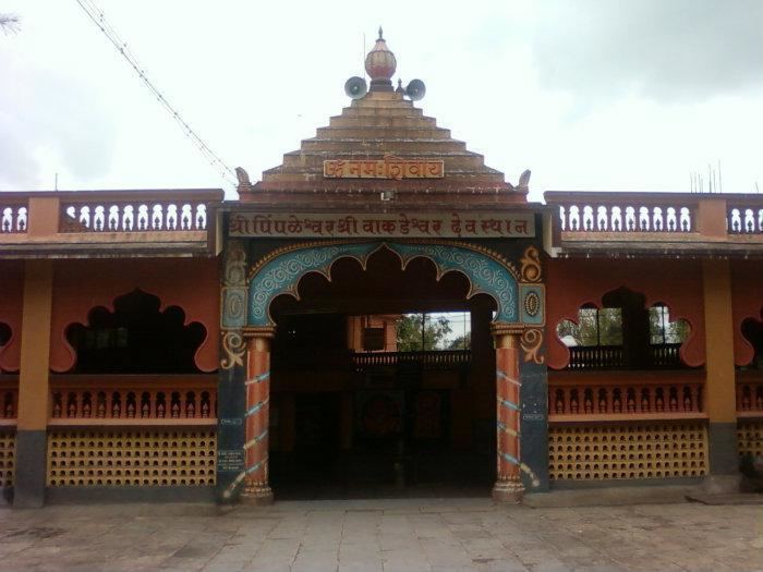 | ||
Kudal (कुडाळ) is a village in the Satara district, Maharashtra, India. It is surrounded by a river called Niranjana or Kudali. There is a big temple of 'Pimpleshwar' at the river coast. It is a village surrounded by natural beauty with greenery of farms all around. Agriculture is the main land use in the village with more than 75% of the total area being used for agricultural activities. The village has a close view to the historic Vairatgad Fort. It is central for 15 villages situated nearby Kudal Village.
Contents
- Map of Kudal Maharashtra
- Demographics
- Geography
- Food
- Climate and rainfall
- Infrastructure and development
- Industries and banks
- Dams and irrigation projects
- Soil
- Agricultural and cropping pattern
- Transport
- Nearby
- References
Map of Kudal, Maharashtra
Demographics
Marathi is the local language. It has a mixed culture of Hindus and Muslims. The village normally shows unity as people from all castes which include Gondhali, Mang, Boudhh, Chambar, Mali, Lohar, Shimpi, Kosthi etc., live in it. Two clans prominent in Kudal are Pawar ,Shinde and Mali clans.
Geography
Kudal is a village in Jawali Taluka in Satara District of Maharashtra State, India. It belongs to Desh or Paschim Maharashtra region and to Pune Division . It is located 21 km towards North from district headquarters Satara, 13 km from Jawali, 202 km from state capital Mumbai Kudal. Pin code is 415514 and postal head office is Kudal (Satara). Kalambhe (3 km), Sarjapur (3 km), Mhasve (3 km), Songaon ( 3 km ), Karandoshi ( 4 km ) are the nearby villages to Kudal. Kudal is surrounded by Wai Taluka towards North, Satara Taluka towards South, Khandala Taluka towards North, Mahabaleshwar Taluka towards west. Wai, Satara, Mahabaleswar, Chiplun are the nearby cities.
Food
The cuisine that the people there usually eat is very spicy and it includes Bhakri, rice, Rajma, Harbara i.e. Gram Dal and vegetables like Fenugreek, Brinjal etc. Non-vegetarians prefer mutton, chicken and emu meat, eggs at rare instances. The well goes with food here normally are papads specially made of Sago for fasting members, Kharda (खरडा), a ground green chilly paste fried with onion and garlic paste is here to be found. Kanda Bhaji, Misal, vada pav and Bhel are one of the most fond snacks and are part of the local breakfast. Kandi Peda is also a looked upon and a want more for the people who have a sweet tooth similarly locally made Sevai served with hot milk and jaggery is also a part of the local desert. Groundnuts boiled in hot salted water and sun dried are some of the favorite local pastimes. Chakulya (चकुल्या), a local delicacy made of wheat flour strips cut and put into a spicy dal well served with rice and some Ghee, is only made and found there.
Climate and rainfall
The climate in general is moderate with temperatures during the summer months (March to mid June) reaching a maximum of 34 °C, and in the winter months (November to March) dropping to 10 °C.The climate is pleasant during the summer, but is very cold during the monsoon. Orelse the climate is moderate for the remaining months. The monsoon period starts in the month of June with the maximum precipitation in July and August. Total rainfall is 3104 mm .The Sahyadri hill ranges -chiefly in Mahabaleshwar tahsil - in the western extremity receive more than 6000 mm. Patan and Jawali tahsils also have rainfall in excess of 2000 mm. Moving eastwards the rainfall amount drops to less than 600 mm in the tahsils of Koregaon, Karad, Satara.
Infrastructure and development
At government offices, Kudal Village is recorded as Kasabe Kudal. Kudal has a government hospital, a veterinary hospital, Bajarpeth (marketplace). Kudal village also has a Grampanchyat of three stored RCC building which is build by Lt.Shri. Gopalrao Bapuso Shinde who was the Sarapanch of Kudal for fifteen years. The roads here are well made and have a great connectivity to all the nearby villages and towns . The bridge built on the Kudali river stands strong to making passing the river easier for the farmers and Transporters
Industries and banks
The Cane sugar mill Pratapgad Sahakari Sakhar Karkhana Ltd., Kudal,Tal. Jaoli, Satara is at the outskirts of Kudal . Similarly Pickles, jams, Fruit syrup, baking and Confectionery are some of the occupations and Businesses carried out in this village.
The major banks that operate there are Bank Of Baroda, Bank Of Maharashtra.
Dams and irrigation projects
The village has two dams named Kudali, located in Mahu and Hatgeghar. The river on which both of these dams are proposed is the Kudali river. The dam at Mahu has a capacity of 1.13 TMC which is the capacity of the dam in Cusec. The Irrigation project conducted there is Kudali Project, located at Mahu and Hatgeghar. The catchment area for the project at Mahu 28.62 km2 (11.05 sq mi), whereas the target command area is 17 km2 (6.6 sq mi). Similarly the one at Hatgeghar has a catchment area of 7.17 km2 (2.77 sq mi), whereas the target command area of 1.4 km2 (0.54 sq mi).
Soil
Black cotton soil is the predominant soil type found there as is the case with most of the districts on the Deccan Plateau.
Lateritic soil covers many parts of the western tahsils of Mahabaleshwar, Javali, Wai and Patan, is typically clayey in nature and reddish in colour.
Soil fertility is especially high in the valley of the river Kudali.
Agricultural and cropping pattern
Major crops (irrigated) are rice, Cotton, Wheat, Gram, Sugarcane, Groundnut for 5 to 6 months (Except Sugar cane).
Major crops (non irrigated) are Bajra, Kharif and Rabi, Jawar, Groundnut for 3 to 4 months.
Major cash crops cultivated are cotton and Sugar for around 3 to 6 months.
Major plantations Fodder Development and Mixed planting goes through Every Year
Besides there is a wide cultivation of fruits like strawberries, raspberries locally known as TuTu, Mangoes and bananas.
Transport
Rail
There is no railway station near to Kudal in less than 10 km. Satara Railway Station (near to Satara), Jarandeshwar Railway Station (near to Satara) are the railway stations reachable from near by towns. However Pune Jn Rail Way Station is major railway station 86 km near to Kudal
Road
National Highway 4 (India) has a close connectivity from Panchwad to this village. Mahabaleswar, Satara, Panchgani are the nearby towns to Kudal having road connectivity to Kudal.
Nearby
Cities
Talukas
Satara - 20 km
Airports
Tourist places
Panchgani - 18 km
Satara - 22 km
Mahabaleshwar - 32 km
Pune - 84 km
Anjanvel - 91 km
Districts
Railway station
Jarandeshwar railway station - 21 km
Palsi railway station - 22 km
Satara railway station - 25 km
Wathar railway station - 26 km
Colleges near Kudal
K.B.P.Polytechnic,Panmalevadi varied Satara
Gourishankar polytechnic,limb Satara
Yoshada Technical Campus Wadhe Satara.
Government Eng. College, Vidhyanagar Karad.
Y.C.College, Satara
Schools near Kudal
Subvillages in Kudal
Kumbharwada