
Elevation 50 m (160 ft) Local time Saturday 6:28 AM | Municipal assoc. Unterspreewald Time zone CET/CEST (UTC+1/+2) Population 632 (31 Dec 2008) | |
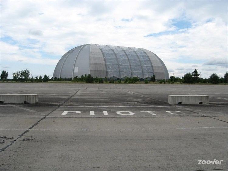 | ||
Weather 3°C, Wind SW at 18 km/h, 94% Humidity Points of interest Tropical Islands Resort, Zum Bogen‑Biwak, Luchsee | ||
Krausnick-Groß Wasserburg is a municipality in the district of Dahme-Spreewald in Brandenburg in Germany.
Contents
Map of 15910 Krausnick-Gro%C3%9F Wasserburg, Germany
Geography
In the middle of the heavily wooded municipality of Krausnick-Groß Wasserburg rise the Krausnick hills (also called the Bergspreewald or Bergspree Woods), which reach a maximum elevation of 144 m above sea level at the summit of the Wehlaberg, and rise about 100 metres above the adjacent Lower Spreewald woods. In the north of the area (in Groß Wasserburg) the Rand Canal branches off the River Spree (Wasserburger Spree) and runs along the Baruth Urstromtal to the Köthener See, which is linked to the River Dahme by the Dahme Flood Relief Canal. The municipality lies ca. 60 km southeast of Berlin.
Demography
Detailed data sources are to be found in the Wikimedia Commons.