
Time zone EET (UTC+2) Elevation 20 m Local time Friday 6:05 AM Area code 0242 | Licence plate 07 Population 13,563 (2012) Postal code 07490 | |
 | ||
Weather 9°C, Wind NE at 3 km/h, 77% Humidity | ||
Konaklı (former Şarapsa and Telatiye) is a town in Antalya Province, Turkey.
Contents
- Map of KonaklC4B1 KonaklC4B1 Mahallesi 07491 Alanya2FAntalya Turkey
- Geography
- History
- Economy
- References
Map of Konakl%C4%B1, Konakl%C4%B1 Mahallesi, 07491 Alanya%2FAntalya, Turkey
Geography
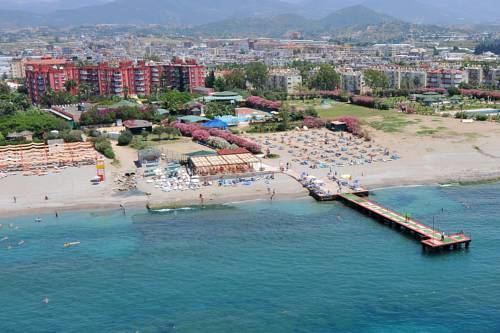
Konaklı is a coastal town in Alanya district of Antalya Province. At 36°35′N 31°53′E it is on Turkish state highway which runs from west to east in south Turkey. Distance to Alanya is 11 kilometres (6.8 mi) and to Antalya is 130 kilometres (81 mi). The population of Konaklı was 13563 as of 2012.
History
There are ruins of the Roman city Augea in the vicinity. The road constructed by the Seljuk sultan Alaattin Keykubat I connecting Alanya to Konya and the Şarapsa Han built by Seljuk sultan Gıyaseddin Keyhüsrev II (both in the 13th century) are in the vicinity. In 1992, Konaklı was declared a seat of township.
Economy
The town economy depends highly on beach tourism. There are fifteen 5-star hotels in the town. Green house agriculture and banana plantations are other profitable sectors.