Parent range Fichtelgebirge Elevation 633 m | ||
 | ||
Similar Sieben‑Linden‑Berg, Platte, Hohe Matze, Großer Kornberg, Epprechtstein | ||
The Kohlberg is a forested mountain made of quartz phyllite in northeast Bavaria, south of Arzberg (Upper Franconia). Its summit is 632 m above sea level (NN) high and it is one of the highest mountains in the Fichtelgebirge range.
Contents
Map of Kohlberg, 95659 Arzberg, Germany
History
Its name comes from the old Kohlenmeilern (wood piles) used to produce charcoal for iron smelters in the Arzberg. The mountain was jocularly called the Zuckerhut (sugar hat), due to the smuggling of sugar over the old border between Bavaria and Prussia.
Structures
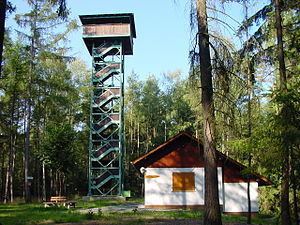
On the summit is the Waldenfelswarte observation post and a refuge hut belonging to the Fichtelgebirge Club (not manned). At its southwestern foot lies the Feisnitz Reservoir and, to the northwest, the Röslau flows around the mountain.
Maps
References
Kohlberg (Fichtel Mountains) Wikipedia(Text) CC BY-SA
