
 | ||
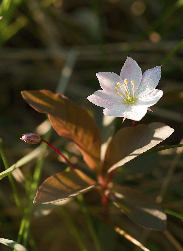
The Fichtelgebirge Club (German: Fichtelgebirgsverein or FGV) is a large walking club and local heritage society in Bavaria and recognised conservation group with 20,000 members in 55 local groups. As the name says, its main sphere of activity is in the Fichtelgebirge mountains in north Bavaria. Its emblem is the Arctic starflower (the Siebenstern).
Contents
Address
Headquarters: Theresienstraße 2, 95632 Wunsiedel in the Haus des Fichtelgebirgsvereins (near the Marktplatz/Rathaus); Expertise and service centre for hiking, paths, conservation, culture and local history; regional specialist library.; FGV Shop; conference and exhibition rooms.
Club aims
The aims of the club are the fostering of hiking, training of hiking guides, marking of footpaths, construction and maintenance of rock climbing facilities, observation towers and accommodation facilities, conservation work and support, landscape conservation, support of local culture, monument protection, running the Fichtelgebirge Museum and other local history and natural history collections, publication of the club magazine Der Siebenstern and other heritage publications, youth work and youth support.
History
In 1878 the Fichtelgebirge Section (Sektion Fichtelgebirg) of the German and Austrian Alpine Club was founed in Wunsiedel. From the outset it focussed only on the development of the Fichtelgebirge. In 1888 the section was disbanded and the FGV founded with its headquarters in Wunsiedel. For a long time it was headed by the master forester (Forstmeister) of Wunsiedel. Over the course of time branches were formed in the surrounding villages and around the turn of the 20th century membership numbers had risen to 1000.
The club enjoyed encouraging growth Aufschwung after the First World War, in 1924 it had 38 local branches with 7000 members. After the Second World War, which had brought the club's activities to a standstill, it underwent a rapid regeneration which saw the foundation of numerous youth groups. In 1936 the headquarters of the club moved to Hof; it returned to Wunsiedel in 2003/04.
Local branches
The club has branches in the following places: Arzberg, Asch (CZ), Bad Alexandersbad, Bad Berneck, Bayreuth, Berlin, Bischofsgrün, Brand/Opf., Ebnath, Fichtelberg, Franken, Gefrees, Goldkronach, Grafenreuth, Hallerstein, Hof/Saale, Hohenberg an der Eger, Kemnath, Kirchenlamitz, Kulmbach, Marktleuthen, Marktredwitz, Mehlmeisel, Münchberg, Nagel, Nemmersdorf, Neusorg, Niederlamitz, Nuremberg, Oberkotzau, Oberwarmensteinach, Pegnitz, Plauen, Pullenreuth, Rehau, Röslau, Schirnding, Schönwald, Schwarzenbach (Saale), Schwarzenhammer, Selb-Stadt, Selb-Plößberg, Sparneck, Speichersdorf, Thiersheim, Thierstein, Tröstau, Vordorf, Waldershof, Warmensteinach, Weidenberg, Weißenstadt, Weißenstein-Verein, Wunsiedel, Zell im Fichtelgebirge.