
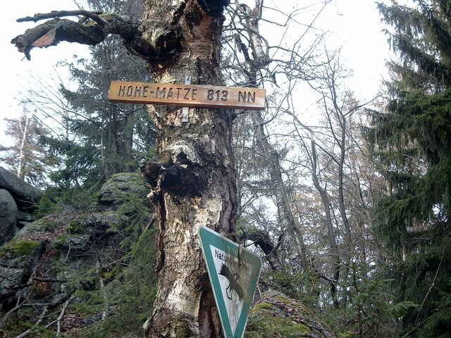
Elevation 813 m | ||
 | ||
Parent range southern Fichtel Mountains Similar Platte, Nußhardt, Kösseine, Rudolfstein, Burgstein | ||
The Hohe Matze, also known as the Hohe Mätze, is a mountain in the southern part of the Fichtel Mountains of central Germany. It lies between Nagel and Tröstau, and its 813 m high summit is a jumble of oval-shaped rocks. There are numerous trails through its wooded slopes.
Map of Hohe Matze, 95697 Tr%C3%B6stauer Forst-West, Germany
On the Hohe Matze was once supposed to have been the castle of Karlstein, but there is no record of it in historical documents. Its name, given in 1393 as mazen, and later as meze or mätze, translates into high German as Weideberg or "willow mountain".
The watershed between the North Sea and the Black Sea runs over the Hohe Matze, as does the 50th parallel and the Höhenweg walking trail.
References
Hohe Matze Wikipedia(Text) CC BY-SA