
Country State | Language spoken District | |
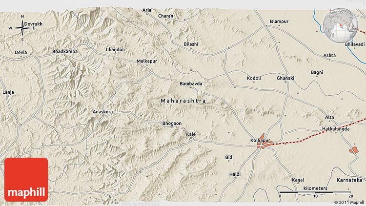 | ||
Map of Kodoli
Kodoli is a census city in Kolhapur district in the Indian state of Maharashtra. It is situated between the foothills of Panhala fort (Ranges) and Warana river. Kodoli is well developed town as per all point of view. Kodoli is home to many and variety of industries. This is one of the unique towns in the Maharashtra where you can get glimpse of modernity and heritage at one place e.g. town still inherits open air theaters. Kodoli is the biggest town in Panhala tehshil.
Contents
- Map of Kodoli
- Dj india audio karad shwo warana kodoli
- Kodoli
- Geography
- Demographics
- Transportation
- Industries in Kodoli
- Schools and educational institutions
- Entertainment
- Nearest cities and town
- References
Dj india audio karad shwo warana kodoli
Kodoli
Geography
Kodoli is located at 16.88°N 74.2°E / 16.88; 74.2. It has an average elevation of 548 metres (1797 feet).
Demographics
As of 2011 India census, Kodoli had a population above 70,000. Males constitute 53% of the population and females 47%. Kodoli has an average literacy rate of 88%, higher than the national average of 59.5%: male literacy is 84%, and female literacy is 76%. In Kodoli, 12% of the population is under 6 years of age. Kodoli is biggest village of Maharashtra state and currently(2014) population is 70,000 but still having Grampanchayat. This is the one of the village who was convert Grampanchayat to Nagarparishad and after few days Nagarparishad to Grampanchayat. Approximate 80% revenue generating from Warana Co-operative area. Kodoli is divided in 8 Part-1.Old Village 2.Anand Nagar 3.Vaibhav Nagar 4.Sakharwadi5.Waranagar 6.Tatyasaheb Kore nagar 7. Vinay Kore nagar 8.Amrut nagar. Kodoli created own identity in india for Big Co-operative Sector. Kodoli also having big Bazarpeth for all materials.
Transportation
Kodoli is well connected to its nearby villages, town and cities by road. One can rely upon the State Transport or commonly referred as ST. However Vadaap is the alternative means of transport which is quite reliable and efficient too. Kodoli connected to NH4 through State H 126.
Industries in Kodoli
Schools and educational institutions
In order of inception
Entertainment
In kodoli first open air theater "Sajay" was started in 1965 and name of owner was Mr.Vasantrao Bandopant Kodgule. He was also Director of one Marathi Movie-"Patale Tar Vhay Mahna" in 1970. After that following talkies established in Kodoli
Closed theaters and VDO's