
Area 1,153 km² Local time Thursday 6:36 AM | Phone number 0186-62-1111 Population 33,064 (Sep 2015) | |
 | ||
Weather -2°C, Wind N at 3 km/h, 79% Humidity | ||
Hot news kitaakita 2017 best of kitaakita japan tourism
Kitaakita (北秋田市, Kitaakita-shi) is a city located in Akita Prefecture, in the Tohoku region of northern Japan.
Contents
- Hot news kitaakita 2017 best of kitaakita japan tourism
- Map of Kitaakita Akita Prefecture Japan
- Geography
- Neighboring municipalities
- Climate
- History
- Economy
- Education
- Airport
- Railway
- Highway
- Local attractions
- Sister city relations
- Noted people from Kitaakita
- References
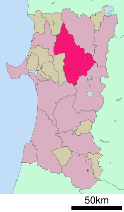
Map of Kitaakita, Akita Prefecture, Japan
As of September 2015, the city had an estimated population of 33,054 and a population density of 28.7 persons per km2. The total area was 1,152.76 square kilometres (445.08 sq mi).
Geography
Kitaakita is located in the mountains of northeastern Akita Prefecture, with the Ou Mountains on the east. Part of the city is within the borders of the Towada-Hachimantai National Park. Much of the city area is covered in forest. Due to its inland location, the city is noted for its heavy snowfall in winter.
Neighboring municipalities
Climate
Kitaakita has a humid continental climate (Köppen climate classification Dfa) with large seasonal temperature differences, with warm to hot (and often humid) summers and cold (sometimes severely cold) winters. Precipitation is significant throughout the year, but is heaviest from August to October.
History
The area of present-day Kitaakita was part of ancient Dewa Province. During the Edo period, the area came under the control of the Satake clan, who ruled the northern third of the province from Kubota Domain. After the start of the Meiji period, the area became part of Kitaakita District, Akita Prefecture in 1878.
The modern city of Kitaakita was established on March 22, 2005, from the merger of the towns of Aikawa, Ani, Moriyoshi and Takanosu (all from Kitaakita District).
Economy
The economy of Kitakita is based on agriculture, forestry and seasonal tourism.