
- Bird Rooster Population 31,560 (Feb 2015) | - Flower Sakura Area 707.5 km² Local time Saturday 10:09 PM | |
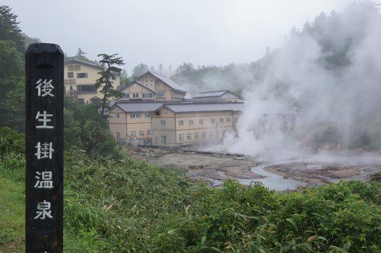 | ||
Weather -3°C, Wind SE at 3 km/h, 92% Humidity Points of interest Oyu Hot Spring, Ōyu Stone Circles, Fukenoyu Hot Spring, Nanataki Falls, Onuma Hot Spring | ||
Kazuno (鹿角市, Kazuno-shi) is a city located in Akita Prefecture, in the northern Tohoku region of Japan.
Contents
- Map of Kazuno Akita Prefecture Japan
- Geography
- Neighboring municipalities
- Climate
- History
- Economy
- Education
- Railway
- Highway
- Local attractions
- Twin towns Sister cities
- Noted people from Kazuno
- References
Map of Kazuno, Akita Prefecture, Japan
As of February 2016, the city had an estimated population of 31,560 and a population density of 44.6 persons per km². The total area was 707.52 square kilometres (273.17 square miles).
Geography
Kazuno is located in a valley in the mountains of far northeastern Akita Prefecture, with the Ou Mountains and Iwate Prefecture on the east. Much of the city is within the borders of the Towada-Hachimantai National Park. Much of the city area is covered in forest. Due to its inland location, the city is noted for its heavy snowfall in winter.
Neighboring municipalities
Climate
Kazuno has a Humid continental climate (Köppen climate classification Dfa) with large seasonal temperature differences, with warm to hot (and often humid) summers and cold (sometimes severely cold) winters. Precipitation is significant throughout the year, but is heaviest from May to August.
History
The area of present-day Kazuno was settled in prehistoric times, and contains major Jomon period archaeological sites and numerous burial mounds from the Kofun period. The area was part of ancient Mutsu Province and was ruled by the Nambu clan of Morioka Domain during the Edo period. After the start of the Meiji period, the area became briefly part of Rikuchū Province before being transferred to Akita Prefecture in 1871. It was organized as part of Kazuno District, Akita Prefecture in 1878.
The modern city of Kazuno was founded on April 1, 1972.
Economy
The economy of Kazuno is based on agriculture, forestry and seasonal tourism.
Education
Kazuno has nine elementary schools, five middle schools and two high schools.
Railway
Highway
Local attractions
Twin towns — Sister cities
Kazuno is twinned with: