
Phone number 0187-43-1111 Area 1,094 km² Local time Monday 12:22 PM | Website Official website Population 27,663 (Dec 2014) | |
 | ||
Weather 4°C, Wind E at 11 km/h, 74% Humidity Points of interest Aoyagi Manor, Lake Tazawa, Dakigaeri Valley, Denshokan Museum 角館樺細工, Akita Kakunodate Nishinomiyake | ||
Semboku (仙北市, Semboku-shi) is a city located in Akita Prefecture, Japan.
Contents
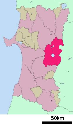
- Map of Senboku Akita Prefecture Japan
- In house bath at kuroyu onsen nyuto onsen semboku akita
- Geography
- Neighboring municipalities
- Climate
- History
- Economy
- Railway
- Highway
- Twin towns Sister cities
- Noted people from Semboku
- References
Map of Senboku, Akita Prefecture, Japan
As of December 2014, the city has an estimated population of 27,663 and a population density of 25.3 persons per km². The total area is 1,093.64 square kilometres (422 sq mi).
In house bath at kuroyu onsen nyuto onsen semboku akita
Geography
Semboku is located in the mountains of central Akita Prefecture, bordering on Iwate Prefecture and the Ou Mountains on the east. Part of the city is within the borders of the Towada-Hachimantai National Park.
Neighboring municipalities
Climate
Semboku has a Humid continental climate (Köppen climate classification Cfa) with large seasonal temperature differences, with warm to hot (and often humid) summers and cold (sometimes severely cold) winters. Precipitation is significant throughout the year, but is heaviest from August to October.
History
The area of present-day Semboku was part of ancient Dewa Province. During the Edo period, the area came under the control of the Satake clan, who had been relocated to Kubota Domain from their former holdings in Hitachi Province. After the start of the Meiji period, the area became part of Semboku District, Akita Prefecture in 1878.
The modern city of Semboku was established on March 22, 2005, from the merger of the towns of Kakunodate and Tazawako, and the village of Nishiki (all from Semboku District).
Economy
The economy of Semboku is based on agriculture, forestry and seasonal tourism.
Railway
Highway
Twin towns — Sister cities
Semboku is twinned with: