
- Tree Sweet Osmanthus Phone number 0277-46-1111 Population 121,704 (2010) | Region Kantō Area 274.6 km² Local time Thursday 3:25 AM | |
 | ||
Weather 3°C, Wind NW at 21 km/h, 68% Humidity Points of interest Kiryugaoka Park, Gunma Insect World, Shinkawa Park, Kiryutenmangu, Suidoyama Park | ||
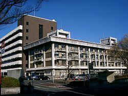
Kiryū (桐生市, Kiryū-shi) is a city located in eastern Gunma Prefecture in the northern Kantō region of Japan. As of February 2015, the city had an estimated population of 114,924 and a population density of 419 persons per km². Its total area was 274.45 km².
Contents
- Map of Kiryu Gunma Prefecture Japan
- Geography
- Surrounding municipalities
- History
- Economy
- Education
- Railway
- Highway
- Local attractions
- Saw tooth roof structures
- Sister city relations
- Noted people from Kiryu
- References
Map of Kiryu, Gunma Prefecture, Japan
Geography
Kiryū is in the southeast part of Gunma, in the northern Kanto Plain near the Tochigi border. It is located approximately 100 kilometres (62 mi) northwest of Tokyo. The city is also not far from Mount Akagi, a large but dormant volcano. The city consists of two separate geographic areas, with the city of Midori sandwiched in between. Situated at the foot of Mount Akagi, the city boasts one of the most beautiful settings in the Kantō region. Two rivers, the Kiryū and the Watarase River, run through the heart of the city and it is likewise surrounded by picturesque mountains to the north. Umeda, a district on the north side of the city, is well known for its cedar trees, while red pines are also common in other areas.
Surrounding municipalities
History
During the Edo period, most of the area of present-day Kiryū was part of the tenryō holding under the direct administration of the Tokugawa shogunate in Kōzuke Province, with the exception of the commercial center and temple town of Kiryū-shinmachi, noted for sericulture since the Nara period, which was part of Shōnai Domain of Dewa Province. The area also prospered from its location on the Kiryū and Watarase rivers.
Modern Kiryū Town was created within Yamada District, Gunma Prefecture on April 1, 1889 with the creation of the municipalities system after the Meiji Restoration. It was raised to city status on March 1, 1921. Kiryū annexed the neighboring village of Sakaino on April 1, 1933 and village of Hirosawa on April 1, 1937. The city expanded further with the annexation of Umeda, Aioi and part of Kawauchi village on October 1, 1954.
On June 13, 2005, Kiryū absorbed the villages of Niisato and Kurohone (both from Seta District).
Economy
Traditionally, Kiryū's principal industry was sericulture and silk textile manufacturing, with records dating silk production as far back as 713. Pachinko manufacturing arrived in Kiryū after World War II, during the period of industrial reconstruction, with the formation of two main companies—the Heiwa Corporation in 1949, and the Sophia Corporation in 1951. Kiryū's factories are responsible for manufacturing 60% of Japan's pachinko machines. However, the decreased demand for silk goods and the closure of several area manufacturing concerns have caused the local economy to suffer.
Mitsuba Corporation, a major manufacturer of automotive parts is headquartered in the city.
Education
There are six public and two private high schools, ten public and two private middle schools, and seventeen public elementary schools in Kiryū. Gunma University School of Science and Technology is located in the Tenjin district of the city.
Railway
Highway
Local attractions
Having been virtually untouched by bombs during World War II, the city boasts one of the greatest concentrations of pre-war architecture in all of Japan.
Saw-tooth roof structures
Kiryu is especially known in the area for saw-tooth roof structures. The official mascot of Kiryu city is a saw-tooth themed character named Kinopi (キノピー). Many of these saw-tooth structures are still in use today, repurposed for various businesses.