
OS grid reference TA018294 Sovereign state United Kingdom Postcode district HU10 Dialling code 01482 | Post town HULL Local time Tuesday 5:41 PM | |
 | ||
Weather 13°C, Wind W at 21 km/h, 58% Humidity | ||
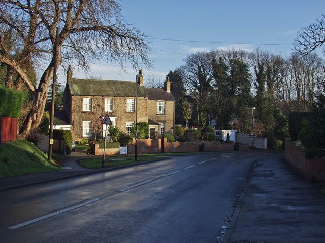
Kirk Ella is a village on the western outskirts of Kingston upon Hull, approximately 5 miles (8 km) west of the city centre, situated in the East Riding of Yorkshire, England.
Contents
- Map of Kirk Ella Hull UK
- Geography
- Early history
- 17501900
- 19002010
- Recent events 2010 present
- Facilities
- Notable people
- References
Map of Kirk Ella, Hull, UK
The place has been a village since at least the 11th century – it remained a relatively unimportant hamlet until the 18th and 19th centuries when it became a location of choice for merchants of Hull wishing to live outside the city. Several large houses were built during this period without any substantial increase in village population. After the 1920s the village grew substantially with large amounts of high quality housing surrounding the traditional village centre – the village continued to grow during the second half of the 20th century, becoming a large suburb, contiguous with Anlaby and Willerby.
Together with West Ella, it forms the civil parish of Kirk Ella and West Ella.
Geography
See also Kirk Ella and West Ella civil parishKirk Ella is primarily residential, but has a few shops. Modern Kirk Ella is contiguous with the suburbs of Willerby to the north; and Anlaby to the east; the village of West Ella is to the west, separated by a golf course; to the south is Hessle separated by under 0.6 miles (1 km) of fields.
The village skirts the foothills of the Yorkshire Wolds to the west, and rises from around 10 to 40 metres (33 to 131 ft) above sea level east to west. Housing stock is affluent, much of it detached or semi detached, with large back gardens; street layouts are irregular, curved, with no main roads passing through the village. Much of the housing development is to the southeast of the original village centre, and church. An area of Kirk Ella including the church, Church Lane, and parts of Packman Lane and Godmans Lane has been designated a conservation area (since 1974), mainly due to its interesting and varied housing stock. The large gardens in much of the village contribute to a wide variety of native and non-native trees and bushes, and thriving wildlife.
Kirk Ella lies within the Parliamentary constituency of Haltemprice and Howden.
The farm known as Kirk Ella Grange is to the northwest, far outside the village, halfway between Raywell and West Ella.
Early history
Known archaically as Aluengi (Domesday Book), or Kirk-Elveley.The name "Kirk Ella" is thought to derive from the Old English, and mean "Aelf(a)'s Woodland Clearing with a Church".
Kirk Ella appears in the 11th century Domesday survey as Aluengi (Ella). There is some evidence for human activity in the area as far back as the Bronze age – bronze axes have been discovered in the area, pottery from the Roman period has also been found, and an Iron Age enclosure visible as cropmarks has been found halfway between the village and Swanland.
After the Norman conquest the village was the property of Ralph de Mortimer, as part of the manor of Ferriby. Ownership passed to the Wake family during the reign of Edward II. Part of the land was given by Thomas Wake (1297–1349) to Haltemprice Priory.
The Church of St Andrew, now a Grade I listed building, dates to the early 13th century (chancel), with a tower dating to the mid 15th century. Much of the structure is of square rubble; the tower is of limestone ashlar; the upper part of the chancel is of rendered brick. The building was restored and remodeled 1859–60, widening the aisles, and a north chapel, south porch and organ chamber added; the tower was restored 1882–83. Other alterations took place in 1886–87 to the chancel north wall and arch; 1890, clerestry windows; 1894 choir vestry, enlarged 1955–56. The church contains numerous monuments and incriptions, many of late 18th and 19th century, many to members of the Sykes family, most notable of which is one to Joseph Sykes (d.1805) by John Bacon junior, similar to a tomb by Louis-François Roubiliac for William Hargrave in Westminster Abbey. In the graveyard are the stones of a Norman arch, and several 19th century table tombs, including a chest tomb of Jane Whitaker, (d.1815, aged 9 months), now a listed structure.
Kirk Ella was once one of the parishes of the county of Hull (Hullshire), established in 1440, and incorporated West Ella, Willerby, Wolfreton and Anlaby, and included a detached within modern day Hull roughly halfway between Hull and Hessle town centres.
By the 17th century lands in Kirk Ella had become the property of several persons including Ralph Ellerker of Risby; George Whitmore; and John Anlaby of Etton.
1750–1900
From the 1750s onwards many of the wealthy merchants and shipowners of Kingston upon Hull began moving their residences out of Hull, mostly westwards towards the higher ground of the wolds foothills and in an opposite direction to the prevailing winds, which carried the factory smells and other pollution eastward. The road from Hull to Anlaby and Kirk Ella was turnpiked in 1745. The influx of Hull merchants is also evidenced in the memorials and tombs in the village church. The fields around Kirk Ella, West Ella and Willerby were enclosed in by acts of 1796 and 1824.
Most of the early movement of Hull merchants was into residences on Church Lane: Richard Williamson, Hull merchant acquired land and built a house at No.4 Church Lane sometime after 1730, The Old Hall was rebuilt 1760, probably by Edward Burrow who acquired the property from another Hull merchant Thomas Haworth 1759; Thomas Bell built The Elms (demolished, the associated early 19th century Elm Lodge remains); and William Mowld established Wolfreton Hall in the same period, both on Church Lane, (Wolfreton Hall was later expanded, refronted in white brick and divided into Wolfreton Grange, and Wolfreton Hall); Kirk Ella House was built c.1778. and a coach house added c.1799; Trevayne at No.6 Church Lane was built c.1830–40 on the site of a previous dwelling. Additionally the Vicarage (No.8), and an adjacent stable/coachhouse were built 1839.
Wolfreton House was built c.1810/15 on the road to Beverley, east of the village centre, the associated stable block also dates to the late 18th/early 19th century. Other merchants had dwellings on Godman's Lane, now demolished; and on Packman Lane: Kirk Ella Hall, a 7 bay yellow-grey brick two storey building in a Tuscan style, was built (1778–79) for William Kirkby, Hull solicitor and white lead manufacturer, by expansion from a pre-existing house. (The Hall is now part of Kirkella Golf Club.) A lodge to the hall was built 1838. There was also a house South Ella, formerly Mount Ella, built for Hull banker Robert C. Pease in the early 19th century.
Other building developments in the 19th century included an infants school (No.11 Packman Lane, 1838, enlarged 1990s); and the Wheatsheaf Inn, rebuilt in 1870 in a Tudor revival style, in the 1850s, The Anchor. The village's population was 306 in 1851, fom 212 in 1801. The village consisted of no more than a few houses on Church Lane, and the east send of Goodmans Lane.
In 1838 the parish of Kirk Ella became part of the Hunsley Beacon Division of the Harthill Wapentake. Extraparochial parts of the parish were transferred to the parish of Newington in 1878, and this area was transferred to the borough of Hull in 1882.
In 1885 the Hull and Barnsley Railway opened, passing northeast of the village centre. – Willerby and Kirk Ella railway station also opened 1885 (closed 1955).
By 1891 the population of the township had risen to 354.
1900–2010
By 1910 the town included a school which had been built on the corner of Mill Road (now Mill Lane) and West Ella Road, and a cemetery at the south end of Mill Lane, approximately 0.5 miles (0.8 km) south of the village, built due to the fullness of the church cemetery. From 1850 to the 1930s there was minimal building growth within the village. An 18-hole golf course designed by James Braid was established west of the village from 1924 by the Hull Golf Club (1921) Limited.
In the 1930s the village began to grow substantially, with new housing developments, much of it semidetached or detached houses with large gardens. New estates were established on Beverley Road leading to Anlaby; on West Ella Road; far along Packman Lane leading to Riplingham, and centred around new roads such as West Ella Way; Westland Road; Elms Drive; Redland Drive; Fairfield Avenue; and St Andrews Mount. By the 1940s the new houses greatly outnumbered the dwellings that had existed up to the 1920s. In the post Second World War period further, during the 1950s to 1960s housing growth of a similar type took place, including new streets and estates on the Vale and South Ella Way off Mill Lane and at Wolfreton Garth. Further infill housing and expansion of housing to the south took place in the next decade, so that by the end of the 1970s an area of around 1 mile (1.6 km) square was completely urbanised, and the development was contiguous with both the expanded villages of Willerby and Anlaby to the north and east. In this period South Ella was built over, and a new large school established (Wolfreton Upper School), south of South Ella Way. The extent of urban growth had reached a near peak, though further housing was built in the last years of the 20th century at the northern edge of the village, around Glenfield Drive; and eastwards at St Julian's Wells; as well as minor infill developments.
Recent events (2010 - present)
During the events of The Queen's Diamond Jubilee celebrations in 2012, the village celebrated by holding a village party in the centre of the village.
In 2015, Wolfreton Upper School in Kirk Ella was made surplus to requirements by the development of a new school building on the field at the back of the Lower School site down Carr Lane in Willerby.The Lower School building has been demolished, but the Upper School building, which was built in 1971, will be demolished at a later date. (see Wolfreton School).
2017 saw the Kirk Ella boundary slightly expand as the new housing estate, currently being built in the fields behind Glenfield Drive, will be addressed to Kirk Ella. Suggested street names were on the theme of flowers; Primrose, Bluebell, Rose, Hemlock, Cowslip, Poppy and Cornflower, in the Parish Council meeting in late November 2016.
Facilities
Kirk Ella has many facilities such as 3 pubs (The Wheatsheaf, The Beech Tree and The Lounge), a Costcutter mini supermarket, post office, newsagents and several hairdressers (including world famous award winning Mark Hill's Salon) and beauty parlours. A quick 20 minute walk from the village centre takes you to Haltemprice Leisure Centre on Springfield Way. There is also a large playing field on Beverley Road, ideal for walking dogs, opposite the bowling green. The village hall is opposite the police station, across the road from the Willerby Square car park.