
Elevation 1,000 m | ||
 | ||
Similar Blue Mountains, Mount Solitary, Narrow Neck Plateau, Jamison Valley, Mount Hay | ||
Kings tableland
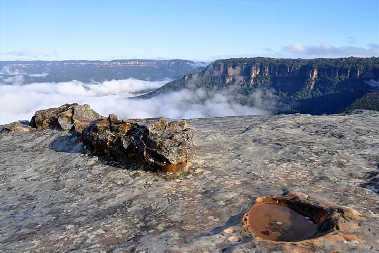
The Kings Tableland is a plateau, located in the Blue Mountains of New South Wales, Australia. The Tableland is an eroded remnant of a sandstone layer that is approximately 1,000 metres (3,300 ft) AMSL, situated immediately south of Wentworth Falls. The Tableland is the major southerly spur of the main spine of the Blue Mountains Range and forms the beginning of the Southern Escarpment, an unbroken series of tall sandstone cliffs which fringes the Jamison, Megalong, Kanimbla and Hartley Valleys.
Contents
- Kings tableland
- Map of Kings Tableland Blue Mountains National Park NSW 2787 Australia
- Indigenous significance
- Modern developments
- References
Map of Kings Tableland, Blue Mountains National Park NSW 2787, Australia
Situated to the west of the locality of Blue Labyrinth, Kings Tableland extends from Bodington Hill south to McMahons Lookout and further about 4.8 kilometres (3.0 mi). The plateau was named by Governor Macquarie after King George III.
Kings tableland
Indigenous significance
A portion of the Kings Tablelands has been gazetted as a camping and meeting place of significance for the Aboriginal Gandangara people. The conserved area includes a sandstone rock platform with extensive grinding and other grooves, a shelter with rock art that has been recorded as being the oldest Aboriginal site in the Blue Mountains region and containing unique vertically engraved depictions of kangaroo and bird tracks.
Modern developments
A road from Wentworth Falls runs north and south along the plateau to the current lookout area of McMahons Point. Before the construction of Warragamba Dam the track continued down the escarpment along a track all the way to the Cox's River area in the Burragorang Valley. There is a track descending from the western edge down into the Jamison Valley, originally leading to the old (now abandoned) sewerage works below the cliffs at Katoomba. The abandoned Queen Victoria Hospital is also located on Kings Tableland.