
 | ||
Similar | ||
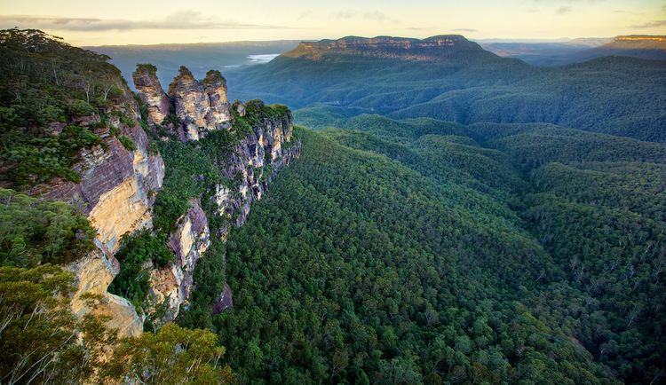
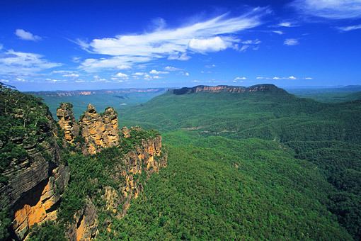
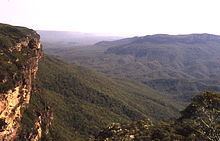
Blue mountains national park jamison valley australia 2009
The Jamison Valley forms part of the Coxs River canyon system in the Blue Mountains of New South Wales, Australia. It is situated approximately 100 kilometres west of Sydney, capital of New South Wales, and a few kilometres south of Katoomba, the main town in the Blue Mountains.
Contents
- Blue mountains national park jamison valley australia 2009
- Yowie sighting audio report 03 in the jamison valley blue mountains new south wales
- Indigenous history
- European history
- Description
- Activities
- References
Yowie sighting audio report 03 in the jamison valley blue mountains new south wales
Indigenous history
The traditional inhabitants of the land in what is now known as the Jamison Valley are the Aboriginal Gundungurra people who are estimated to have lived in the region for 40,000 years, stretching south towards the Burragorang Valley, north of Goulburn.
European history
The Jamison Valley was named by Governor Lachlan Macquarie in honour of Sir John Jamison (1776-1844), a prominent landowner and physician who visited the Blue Mountains with the governor in 1815.
Later, as local towns were beginning to develop, the British naturalist Charles Darwin toured the area. He stayed at the Weatherboard Inn in Wentworth Falls in 1836, and undertook a walk along Jamison Creek to the escarpment of the Jamison Valley, where he was suitably impressed by the spectacular views. His route is now commemorated as Darwin's Walk, starting in Wilson Park, Wentworth Falls, and following Jamison Creek to the escarpment.
Coal mining in the valley was started around 1872 by John Britty North, with large-scale infrastructure (Katoomba Scenic Railway) used to overcome the terrain.
Description
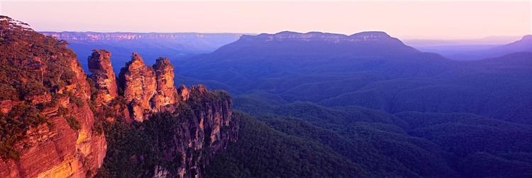
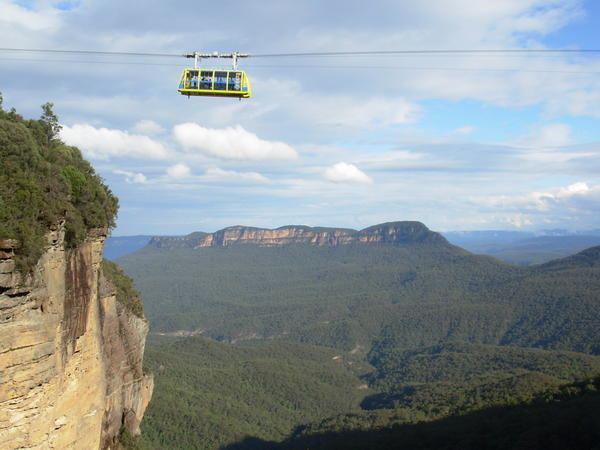
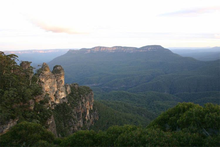
The Jamison Valley stretches north-south from just outside Katoomba to the Mount Solitary ridge; in this direction it is approximately 4 kilometres (2.5 mi) long. From west to east, it stretches from Narrow Neck Plateau to Kings Tableland, making it approximately 10 kilometres (6.2 mi) wide. Like the entire Sydney and Blue Mountains region, the valley is a sandstone area, characterised by steep sandstone cliffs. Deeper into the soil there is a layer of shale, which is softer than the sandstone. As this layer of shale was eroded by the watercourses, it collapsed and brought the sandstone down with it, creating the characteristic sandstone valleys and canyons of the Blue Mountains, of which the Jamison Valley is one.
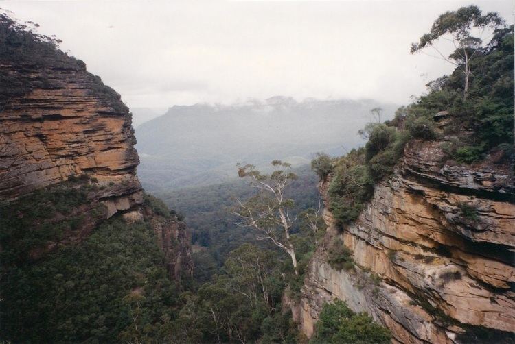
The valley is densely forested, with eucalypt forest over most of its expanse and occasional pockets of semi-rainforest in gullies, where water is concentrated. The northern escarpment is deeply serrated, having been carved up by watercourses over millions of years. Watercourses include Jamison Creek, Valley of the Waters Creek, Gordons Creek, Leura Falls Creek, Kedumba River and Causeway Creek. There are also numerous waterfalls, including Wentworth Falls, Empress Falls, Vera Falls, Gordon Falls, Leura Falls and Katoomba Falls.
In this part of the valley there was formerly a sewage treatment plant, not far below the northern escarpment. It was serviced by a dirt road that went up to Kings Tableland and thence to Wentworth Falls town. The plant was closed down in the 1990s, but the service road remains and can be used by bushwalkers.
The only mountain in the valley is Mount Solitary, which sprawls across the south of the valley from west to east. It is joined to Narrow Neck Plateau by a low ridge which is also the site of the Ruined Castle, a rock formation that is popular with bushwalkers. Immediately east of Mount Solitary is a property called Kedumba Farm, which is no longer worked as a farm.
South of Mount Solitary, the valley sprawls through Cedar and Kedumba Valley down to Coxs River and Lake Burragorang, the lake that was created when Warragamba Dam was built. There is a 3 kilometres (1.9 mi) prohibited area around the river and lake to protect Sydney's water supply. Around this area there is a high-tension power line that crosses the valley from east to west; it is followed by a series of service roads that provide access to the powerline and to the area, although much of it is in the prohibited area. These service roads make it possible to do a trek taking in the whole valley, but it is necessary to get permission from Sydney Water to go through the prohibited area. The Katoomba and Jamison topographic maps are essential for any of these walks.
Activities
The Jamison Valley is a popular place for bushwalking and camping. There is an extensive network of tracks across the northern escarpment, including Darwin's Walk, the tracks in the Valley of the Waters and old, neglected tracks that Blue Mountains bushwalkers have been trying to restore for years. Tracks are also found along the cliffs near Leura and Katoomba, as well as the popular tracks like the Federal Pass, located at the foot of the cliffs. A track also goes west around to the Ruined Castle and Mount Solitary. The track continues across the mountain but is patchy and suitable only for experienced walkers. It is possible to then go up to Kings Tableland and into Wentworth Falls, making a trek of at least three days. The tracks closer to the escarpment are suitable for one-day walks and are used extensively for this purpose. Mount Solitary is used mostly for camping trips, although fit walkers have been known to make one-day walks to the mountain.