
Country Kenya | County Nairobi County Elevation 5,600 ft (1,700 m) | |
 | ||
Kilimani is a neighborhood in the city of Nairobi, the capital and largest city of Kenya. The name also applies to an electoral ward of Nairobi County in Dagoretti North Constituency, which is larger than the neighborhood.
Contents
Map of Kilimani, Nairobi, Kenya
Location
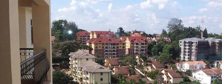
Kilimani is located approximately 4 kilometres (2 mi) west of Nairobi's central business district. This is south of Lavington and north of Woodley. The coordinates of the neighborhood are: 01°17'06.0"S, 36°47'12.0"E (Latitude:-1.285000; Longitude:36.786667).
Overview
The neighborhood was established as a Whites-only residential area by the British colonialists in the mid 20th century. I was not until the 1960s when it was racially integrated. The neighborhood has historically been primarily low-density residential, but since 2000 has become increasingly high-density mixed residential and commercial; both retail and offices.
Points of interest
State House Nairobi, the official residence of the President of Kenya is located in Kilimani, on State House Road.
(1) Kilimani Primary School, Milimani Primary School, St Hannah's School, St. Nicholas School, St Christophers School, Cavina School are all located in the neighborhood. (2) The Lycée Denis Diderot, the French international school, is in Kilimani. It moved there in 1972. (3) West Nairobi School, a Christian international school, opened in Kilimani in 1996 but moved to Karen in 2000. (4) State House Girls' School is located on the grounds of State House Nairobi.
The headquarters of Sidian Bank are located on Wood Avenue in Kilimani.
Yaya Centre, is a shopping mall with over 100 retail shops.