
Palestine grid 165/169 | ||
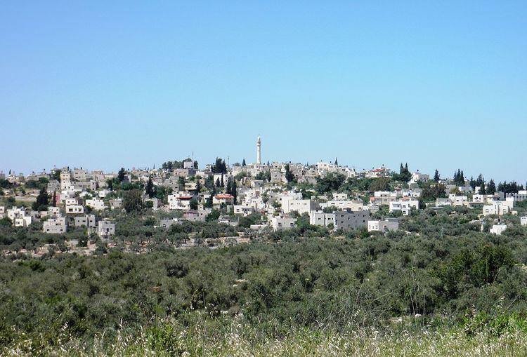 | ||
Name meaning "The village of the guard" Weather 13°C, Wind W at 13 km/h, 71% Humidity | ||
Kifl Haris (Arabic: كفل حارس) is a Palestinian village in the northern West Bank, located six kilometers west of Salfit and 18 kilometers south of Nablus in the Salfit Governorate, northwest of the Israeli settlement city Ariel.
Contents
- Map of Kifl Hareth
- History
- Ottoman Empire
- British Mandate of Palestine
- 1948 1967
- post 1967
- Tomb of Joshua
- Israeli Palestinian conflict
- References
Map of Kifl Hareth
History
Sherds from the Middle Bronze Age, Iron Age II, Persian, Hellenistic, Roman, Byzantine/Umayyad, Crusader/Ayyubid and Mamluk eras have been found here.
Ottoman Empire
In 1517, the village was incorporated into the Ottoman Empire with the rest of Palestine, and in 1596, Kafr Harit appeared in Ottoman tax registers as being in nahiya (subdistrict) of Jabal Qubal under the liwa' (district) of Nablus. It had a population of 54 households, all Muslim. They paid taxes on occasional revenues, goats and/or beehives, and a fixed amount. Sherds from the early Ottoman era have also been found.
In the late Ottoman period, in 1870, the French explorer Victor Guérin reached the village, after walking through "beautiful plantations of figs and olives". He estimated it had 600 inhabitants. The name of this place was given to Guérin as Kefil Haris. The Wely marked on the Palestine Exploration Fund 1880s map as Sheikh Ata, 1 mile north-east of Kefr Haris, is called by him Sheikh Khather. He also calls attention to the remains of an old watchtower built of large, well-cut stones, between Deir Estia and Kefr Haris. At the latter place he found two broken marble columns built up in the wall of the mosque.
In 1882, it was described as a "somewhat small village on high ground, with olive groves to the east. It has three sacred places, Neby Kifl, Neby Nun, and Neby Lusha."
British Mandate of Palestine
In the 1922 census of Palestine conducted by the British Mandate authorities, Kufr Hares had a population of 373, all Muslim, increasing in the 1931 census to 562 persons, still all Muslim, in 130 houses.
In 1945 the population was 770 Muslims while the total land area was 9,393 dunams, according to an official land and population survey. Of this, 4,117 were allocated for plantations and irrigable land, 2,131 for cereals, while 32 dunams were classified as built-up areas.
1948-1967
In the wake of the 1948 Arab–Israeli War, and after the 1949 Armistice Agreements, Kifl Haris came under Jordanian rule.
post-1967
After the Six-Day War in 1967, Kifl Haris has been under Israeli occupation.
Tomb of Joshua
According to a Samaritan tradition, noted in 1877, the tombs of Joshua and Caleb were in Kifl Haris.
Biblical tradition places the tomb of Joshua, Caleb, and Nun according to Joshua 24:30 in Timnath-heres which is attributed to be the current location of Kifl Haris. Thousands make the pilgrimage to the tombs on the annual commemoration of Joshua's death, 26th of Nisan on the Hebrew calendar.
Israeli Palestinian conflict
According to the United Nations OCHA, three local residents were killed during the First Intifada and one during the Second Intifada.
On 14 March 2013, Adele Biton was critically injured (later dying from her injuries), and her mother and two sisters were moderately injured, after their car crashed after Palestinians threw stones their way near the village. Five youths from Kifl Haris were charged by a military court for responsibility for the incident, and as of February 2015 the case has not yet been concluded.
In June 2014, Jamil Ali Abed Jabir died during a night raid by the IDF. Locals say he suffered a heart attack while defending his home. According to an IDF spokesman, his house wasn't raided.
In 2015, an Israeli tour of the site was preceded by a convoy of military vehicles which closed off the town entrances and imposed a shutdown of all the village shops so Israeli tourists could visit the tomb for several hours.