
Local time Monday 3:34 PM | Elevation 1,211 m | |
 | ||
Weather 27°C, Wind S at 14 km/h, 70% Humidity | ||
Nubian meeting kibuli kampala
Kibuli is a hill in the center of Kampala, the capital and largest city in Uganda. The name also applies to the commercial and residential neighborhoods on that hill.
Contents
- Nubian meeting kibuli kampala
- Map of Kibuli Kampala Uganda
- Location
- Overview
- Points of interest
- References
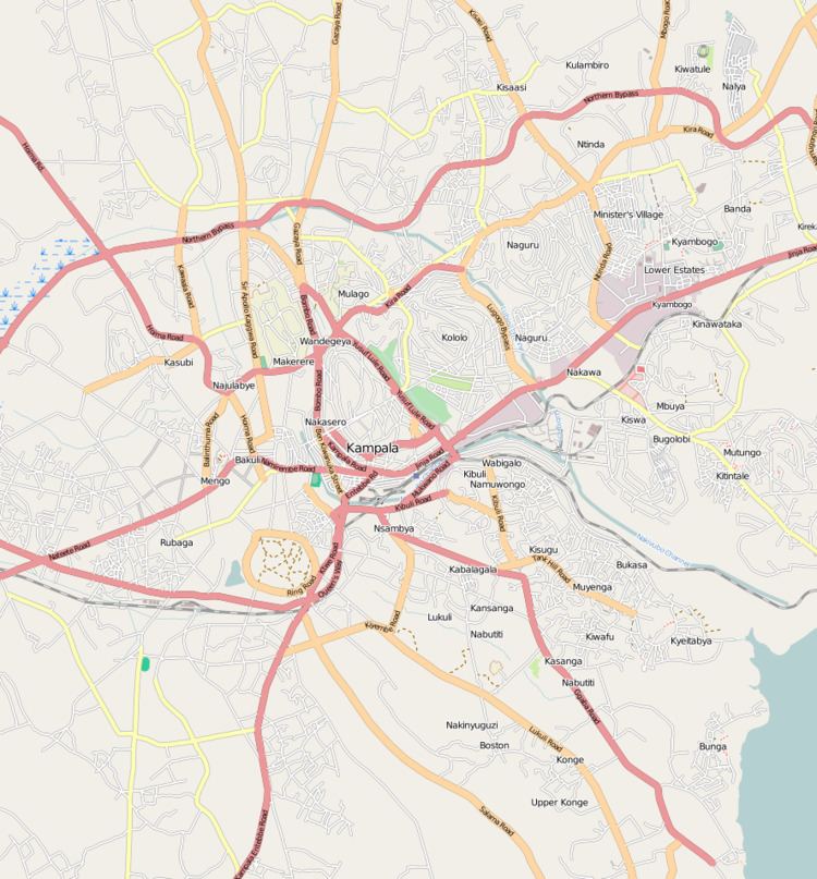
Map of Kibuli, Kampala, Uganda
Location
Kibuli Hill is bordered by Kololo to the north, Nakawa and Mbuya to the northeast, Namuwongo to the east, Muyenga to the southeast, Kabalagala to the south, Nsambya to the southwest, the Queen's Clock Tower to the east and Nakasero to the northeast. Kibuli is located approximately 6 kilometres (3.7 mi) southeast of Kampala's central business district. The coordinates of Kibuli Hill are:0°18'36.0"N, 32°35'42.0"E (Latitude:0.3100; Longitude:32.5950).
Overview
Kibuli Hill rises to a peak of 3,973 feet (1,211 m), above sea level. Prince Badru Kakungulu, a member of the Buganda Royal Family owned most of the hill, before he donated it to the Ugandan Moselem community. That land today houses the Kibuli Mosque, Kibuli Secondary School, Kibuli Hospital and Kibuli Teacher Training College. The hill also accommodates a police training school and a teacher training college. At the base of the hill, on the eastern side of Kibuli, is the neighborhood called Namuwongo, the location of the old Industrial Area of the city and the oil depots of three major oil companies; Shell, Total, and Caltex.
Points of interest
The following points of interest lie on Kibuli Hill: