
Airport type Public 3/21 3,592 Elevation 91 m | Owner City of Kerrville Elevation AMSL 1,617 ft / 493 m Code ERV Phone +1 830-896-9399 | |
 | ||
Website www.KerrvilleAirport.com Address 1877 Airport Loop, Kerrville, TX 78028, USA Similar Air Evac Ems Inc, Kerrville Aviation, Schreiner University, Dugosh Aircraft Services I, Gillespie County Airport‑T82 | ||
Kerrville Municipal Airport (IATA: ERV, ICAO: KERV, FAA LID: ERV) (Louis Schreiner Field) is six miles southeast of Kerrville, in Kerr County, Texas. The National Plan of Integrated Airport Systems for 2011–2015 categorized it as a general aviation facility.
Contents
History
The airport opened in February 1943 as Louis Schreiner Field and was used by the United States Army Air Forces as a training base. At the end of the war the airfield was determined to be excess by the military and turned over to the local government for civil use.
Trans-Texas DC-3s stopped there until 1959-60.
Facilities
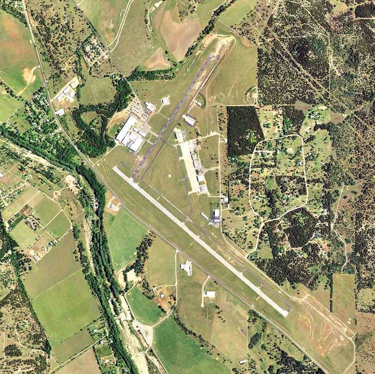
Kerrville Municipal Airport covers 528 acres (214 ha) at an elevation of 1,617 feet (493 m). It has two asphalt runways: 12/30 is 6,000 by 100 feet (1,829 x 30 m) and 3/21 is 3,592 by 60 feet (1,095 x 18 m).
In the year ending August 5, 2011 the airport had 59,800 general aviation operations, average 163 per day. 149 aircraft were then based at the airport: 86% single-engine, 5% multi-engine, 3% jet, 5% helicopter, and 1% glider.