
Elevation 11,709 feet (3,569 m) Traversed by Bubbs Creek Trail | Range Sierra Nevada | |
 | ||
Similar Sierra Nevada, Glen Pass, Rae Lakes, Forester Pass, Mount Gould | ||
Backpacking kearsarge pass
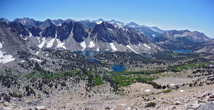
Kearsarge Pass is a pass in the Sierra Nevada of California. The pass lies on the Sierra Crest at 11,709 feet (3,569 m). The pass permits foot traffic between Kings Canyon National Park and the John Muir Wilderness.
Contents
- Backpacking kearsarge pass
- Map of Kearsarge Pass California USA
- Pacific crest trail thru hike 2016 kennedy meadows kearsarge pass bishop ca
- References
Map of Kearsarge Pass, California, USA
The pass was named after the Kearsarge mine to the east, which was named by its owners after the USS Kearsarge, a ship that destroyed the CSS Alabama. The Alabama Hills were named after the latter ship, and the mine was named in reaction. The first known crossing of Kearsarge Pass was in 1864.
Pacific crest trail thru hike 2016 kennedy meadows kearsarge pass bishop ca
References
Kearsarge Pass Wikipedia(Text) CC BY-SA