
Topo map USGS Mount Williamson Range Sierra Nevada | Elevation 4,009 m | |
 | ||
Similar John Muir Trail, Glen Pass, Sierra Nevada, Kearsarge Pass, Rae Lakes | ||
Pacific crest trail forester pass
Forester Pass is a mountain pass in the Sierra Nevada. Located on the Kings-Kern Divide on the boundary between Sequoia National Park and Kings Canyon National Park, Forester Pass connects the drainages of Bubbs Creek and the Kern River. At 13,153 feet (4,009 m), Forester Pass is the highest point along the Pacific Crest Trail.
Contents
- Pacific crest trail forester pass
- Map of Forester Pass California USA
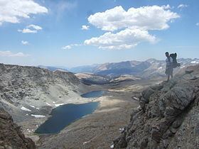
- View from forester pass kings canyon national park california pct 2014
- References
Map of Forester Pass, California, USA
Originally discovered by a group of United States Forest Service workers, it was subsequently named in their honor.
On August 26, 1930, four men, including 18-year-old Donald Downs were injured during construction of the pass. A boulder let loose during blasting of the trail crushed Mr. Downs' arm. The men were evacuated by stretcher, Downs to Baxter Cabin and the others to Independence. Mr. Down’s arm was amputated. He died on Sept. 2, 1930 from complications of surgery. A plane crashed at Tyndall Creek after dropping medicine for Downs. A plaque commemorating his death is found on the southern side of the pass, most easily seen while walking in a northerly direction.