Supriya Ghosh (Editor)

Kežmarok District

Updated on
Edit
Like
Comment
Share on FacebookTweet on TwitterShare on LinkedInShare on Reddit
Country
  
Slovakia

Population
  
70,487 (2010)

Time zone
  
CET (UTC+1)

Region kraj
  
Prešov Region

Kežmarok District

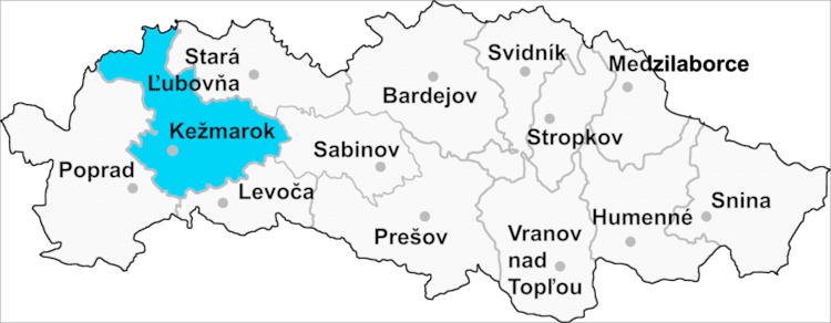
Kežmarok District (Slovak: okres Kežmarok) is a district in the Prešov Region of eastern Slovakia. It is situated in the western part Prešov Region. Kežmarok district borders Stará Ľubovňa District, Levoča District, Poprad District, Sabinov District and Poland. It lies mainly on a foothills of High Tatras. Kežmarok district was established in 1923 and in its present borders exist from 1996. It belongs to the smaller Slovak districts with lower population density. The administrative center is Kežmarok town, but the district also profits from the proximity of larger Poprad.

Contents

Map of Ke%C5%BEmarok District, Slovakia

Municipalities

  • Abrahámovce
  • Bušovce
  • Červený Kláštor
  • Havka
  • Holumnica
  • Hradisko
  • Huncovce
  • Ihľany
  • Javorina
  • Jezersko
  • Jurské
  • Kežmarok
  • Krížová Ves
  • Lechnica
  • Lendak
  • Ľubica
  • Majere
  • Malá Franková
  • Malý Slavkov
  • Matiašovce
  • Mlynčeky
  • Osturňa
  • Podhorany
  • Rakúsy
  • Reľov
  • Slovenská Ves
  • Spišská Belá
  • Spišská Stará Ves
  • Spišské Hanušovce
  • Stará Lesná
  • Stráne pod Tatrami
  • Toporec
  • Tvarožná
  • Veľká Franková
  • Veľká Lomnica
  • Vlková
  • Vlkovce
  • Vojňany
  • Vrbov
  • Výborná
  • Zálesie
  • Žakovce
  • Local Enterprises

  • Isometall, s.r.o. - metal (steel, iron, etc.) manufacture - (http://www.isometall.sk)
  • References

    Kežmarok District Wikipedia