
Administrative center Ulken Narym Founded 1928 Population 28,008 (2013) | Time zone East (UTC+6) Area 13,167 km² | |
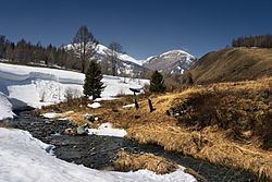 | ||
Katonkaragay, also spelled Katon-Karagay (Kazakh: Қатонқарағай ауданы (Katonqarahay audany)) is a district of East Kazakhstan Region in eastern Kazakhstan. The administrative center of the district is the selo of Ulken Narym (Bolshenarymskoye) (49°12′41″N 84°30′50″E) (Kazakh: Үлкен Нарым ауылы (Ylken Narym auyly)). It is the easternmost district in Kazakhstan. Population: 28,008 (2013 estimate); 30,056 (2009 Census results); 45,149 (1999 Census results).
Map of Katonkaragay District, 070000, Kazakhstan
Near the selo of Berel (49°22′24″N 86°26′17″E) excavations of ancient burial mounds have revealed artefacts the sophistication of which are encouraging a revaluation of the nomadic cultures of the 3rd and 4th centuries BC.
References
Katonkaragay District Wikipedia(Text) CC BY-SA