Time zone CET (UTC+1) Area 53.9 km² Dialling code 0473 | Dialing code 0473 Local time Friday 11:59 PM Postal code 39020 | |
 | ||
Frazioni Kastelbell (Castelbello), Tschars (Ciardes), Freiberg (Montefranco), Galsaun (Colsano), Juval (Juvale), Latschinig (Lacinigo), Tomberg (Montefontana), Trumsberg (Montetrumes) Demonym(s) German:Kastelbeller or TscharscherItalian: castelbellesi Weather 4°C, Wind NW at 21 km/h, 27% Humidity Region Trentino-Alto Adige/South Tyrol | ||
Val venosta il castello di castelbello ciardes schloss kastelbell tschars video slide
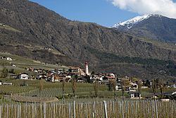
Kastelbell-Tschars ( [ˌkastəlˈbɛl-tʃaˑrs]; Italian: Castelbello-Ciardes [kaˌstɛlˈbɛllo ˈtʃardes]) is a comune (municipality) in South Tyrol in northern Italy, located about 40 kilometres (25 mi) northwest of Bolzano.
Contents
- Val venosta il castello di castelbello ciardes schloss kastelbell tschars video slide
- Map of 39020 Castelbello ciardes Province of Bolzano South Tyrol Italy
- Geography
- Coat of arms
- Linguistic distribution
- References
Map of 39020 Castelbello-ciardes Province of Bolzano - South Tyrol, Italy
Geography
As of 30 November 2010, it had a population of 2,387 and an area of 53.9 square kilometres (20.8 sq mi).
Kastelbell-Tschars borders the following municipalities: Latsch, Naturns, Schnals and Ulten.
Coat-of-arms
The emblem is a gules mill wheel, with eight paddles, on argent background. It retakes the insignia of Counts Hendl owners of the castle from 1531 to 1949.
Linguistic distribution
According to the 2011 census, 98.72% of the population speak German and 1.28% Italian as first language.
References
Kastelbell-Tschars Wikipedia(Text) CC BY-SA
