
Time zone EAT (UTC+3) Local time Friday 10:06 PM | Elevation 1,000 m | |
 | ||
Weather 24°C, Wind SW at 3 km/h, 57% Humidity | ||
Karuma Falls is a town in Uganda.
Contents
Map of Karuma Village, Uganda
Location
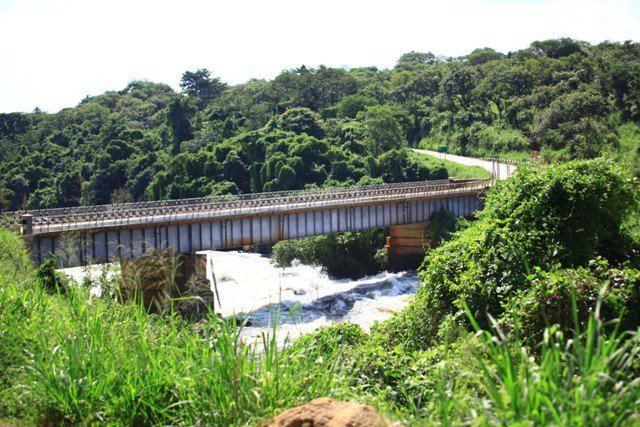
Karuma Falls is located on the Kigumba-Gulu Highway, immediately south of where the highway crosses the River Nile. Karuma Falls is approximately 97 kilometres (60 mi), by road, northeast of Masindi and approximately 77 kilometres (48 mi), by road, south of Gulu, the largest city in Northern Uganda. Karuma Falls is also the location of Karuma Power Station, the largest hydropower project in Uganda with a planned capacity of 600 megawatts. The coordinates of Karuma Falls are 2° 14' 3.00"N, 32° 14' 47.00"E (Latitude:2.234167; Longitude:32.246390). The average elevation of Karuma Falls is about 1,000 metres (3,300 ft) above sea level.
Overview
In March 2013, Ugandan print media reported that the national government was planning a large modern city to be constructed at the site of the current town, to include the site of the proposed Karuma Power Station currently under construction.
Points of interest
The following additional points of interest are found at or near Karuma Falls: