
 | ||
Similar Kopet Dag, Nisa - Turkmenistan, Aýrybaba, Geok Tepe, Repetek Biosphere State Res | ||
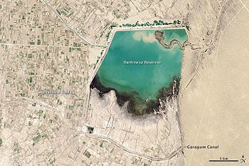
The Karakum Canal (Qaraqum Canal, Kara Kum Canal, Garagum Canal; Russian: Каракумский канал, Karakumsky Kanal, Turkmen: Garagum kanaly, گَرَگوُم كَنَلیٛ, Гарагум каналы) in Turkmenistan is one of the largest irrigation and water supply canals in the world. Started in 1954, and completed in 1988, it is navigable over much of its 1,375-kilometre (854 mi) length, and carries 13 cubic kilometres (3.1 cu mi) of water annually from the Amu-Darya River across the Karakum Desert in Turkmenistan. The canal opened up huge new tracts of land to agriculture, especially to cotton monoculture heavily promoted by the Soviet Union, and supplying Ashgabat with a major source of water. Unfortunately, the primitive construction of the canal allows almost 50 percent of the water to escape en route, creating lakes and ponds along the canal, and a rise in groundwater leading to widespread soil salinization problems. The canal is also a major factor leading to the Aral Sea environmental disaster.
Contents
Map of Garagum Kanaly, Turkmenistan
History
The current Karakum Canal was not the first major attempt to bring the Amu-Darya water to the Karakums. In the early 1950s, construction began on the Main Turkmen Canal (Russian: Главный Туркменский канал), which would start at a much more northerly location (near Nukus), and run southwest toward Krasnovodsk. The canal would have used around 25 percent of the Amu-Darya's water. The works were abandoned after the death of Joseph Stalin, the current Karakum Canal route being chosen instead. Reservoirs such as Hanhowuz Reservoir were created to help regulate it.