
Country State Founded kampilaraya | Language spoken District | |
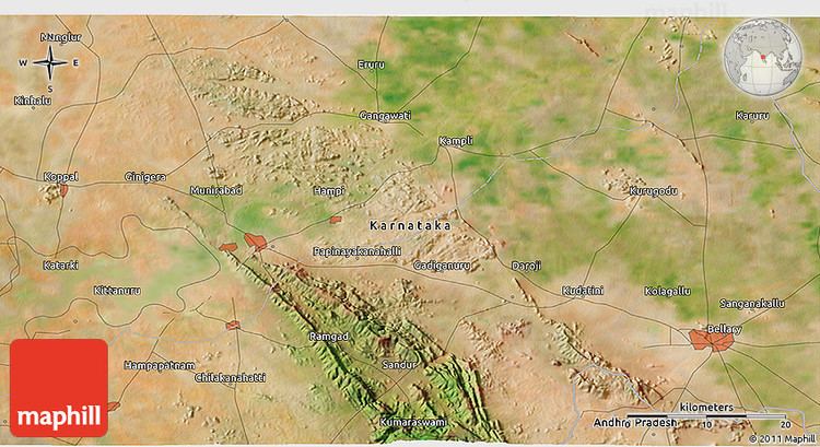
Map of Kampli
Kampli is a town in the Bellary district, Kampli taluk, in the Indian state of Karnataka. The town is situated about 15 km away from world famous Hampi.
Contents
- Map of Kampli
- Farmer killed 15 foot long python for it swallows monkey in magani village of kampli
- Kampli urs e shareef of hazrath syed shah mustafa qadri urf bade sahab qadri in 2017
- Administration
- Economy
- Education
- Politics
- Geography
- Demographics
- Transport
- References
Farmer killed 15 foot long python for it swallows monkey in magani village of kampli
Kampli urs e shareef of hazrath syed shah mustafa qadri urf bade sahab qadri in 2017
Administration
Kampli is administered by town municipality. The town has many government offices such as a Primary Health Centre, Police Station, Registrar office, village office, Banks,Post office, Telephone exchange, Electricity board etc.
Economy
Kampli is an economic hub for its surrounding villages. On every Tuesday, vendors of various commodities assemble at the town's market for buying and selling. Kampli boasts nearly 20 rice mills, an accomplishnent for a small town. Agriculture is the backbone of its economy. The Tungabhadra River is a major source of irrigation for most of Kampli's agricultural land. The major crops in this area are Paddy, Sugar Cane, Banana and coconut.
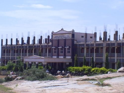
Education
Kampli has many educational institutions ranging from kindergarten to Degree colleges. The town also has couple of primary schools and high schools, specifically for girls. Some of the noted schools and colleges are: Govt First Grade College, Shamiachand Junior(S.M.G.J.) College,Kalmat High School,Govt Girls High School, Bharatiya Shishu Vidhyalaya (B.S.V), Govt primary schools, Govt Urdu school, Vidya Sagara Residential School, Sharadha Vidya Niketan, Vidyasagar, Bright way public school, Vijayanagara, Chetana School, Govt polytechnic college, shanthi vidyaniketha school,Srimathi Odso jademma primary, high school, PU college and ITI,Vidyaranya ITI college and Pragathi ITI and JTS (Junior Technical School), keonics computer institution ( famous computer institute)
Politics
With the delimitation of constituencies by the [[Delimitation commission]], Kampli has been conferred an assembly constituency status. In the Karnataka state assembly elections, 2013, the [[Bharatiya Janata Party]] candidate won the election by beating his Rebel Congress opponent by more than 35,000 votes. In the Town Municipal Elections, the Bharatiya Janata Party won with a major lead and Hemavathi is the current municipal chairman.
Geography
Kampli is located at: 15.4°N 76.62°E / 15.4; 76.62. It has an average elevation of 414 metres (1358 feet).
Demographics
As of 2011 India census, Kampli had a population of 39,307. Males constitute 50% of the population and females 50%. Kampli has an average literacy rate of 55%, lower than the national average of 59.5%: male literacy is 65%, and female literacy is 46%. In Kampli, 13% of the population is under 6 years of age. Kampli has spread around 16,363,627,77 squarefeets. It is a developing town,
Transport
Kampli is well connected by road to Gangavathi, Hospet and Bellary. Karnataka State Road Transport Corporation (KSRTC) runs a bus service to other cities and villages. There are also various private bus services.
Hospet is the nearest railway station to Kampli is 32 kilometre away and Hospet lies on Hubli-Guntakal line.