
Elevation 2,558 m | Highest point Grintovec | |
 | ||
Mountains Similar | ||
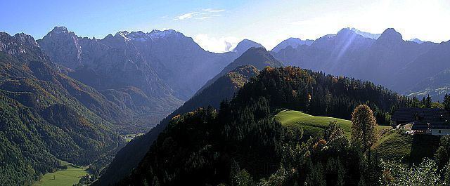
On our way up to the highest mountain the kamnik savinja alps 2558m
The Kamnik–Savinja Alps (Slovene: Kamniško-Savinjske Alpe) are a mountain range of the Southern Limestone Alps. They lie in northern Slovenia, except for the northernmost part, which lies in Austria.
Contents
- On our way up to the highest mountain the kamnik savinja alps 2558m
- Map of Kamnik Savinja Alps 4206 Zgornje Jezersko Slovenia
- GeographyEdit
- Mountains and passesEdit
- References
Map of Kamnik-Savinja Alps, 4206 Zgornje Jezersko, Slovenia
The western part of the range was named the Kamnik Alps (German: Steiner Alpen) in 1778 by the scientists Belsazar Hacquet and Franz Xaver von Wulfen, after the town of Kamnik (Stein) in the valley of the Kamnik Bistrica River. Its eastern part was named the Savinja Alps (Sanntaler Alpen) or Solčava Alps (Sulzbacher Alpen) by the mountaineer Johannes von Frischauf in 1875, after the settlement of Solčava (Sulzbach) and the main river, the upper Savinja (Sann).
On our way up to the highest mountain the kamnik savinja alps 2558m
GeographyEdit
The Kamnik–Savinja Alps are located south of the Karawanks range at the border of Austria and Slovenia, stretching from the Sava River in the west to the Savinja in the east, where the adjacent Slovenian Prealps with the Pohorje range, the Celje Hills at the Dravinja River, as well as the Sava Hills are located. In the northwest, the valley of Vellach Creek (at 46°22′21″N 14°33′55″E) leading to Bad Vellach is the southernmost point of both the Austrian state of Carinthia and Austria as a whole.
The entire main chain is today part of Slovenia. Historically it formed the border between the Inner Austrian duchies of Carinthia, Styria, and Carniola. The tripoint was located at the Carinthia Mount Rinka (Slovene: Koroška Rinka).
There is also a small glacier below Mount Skuta, which is the easternmost glacier in the Southern Alps.
Mountains and passesEdit
The most important peaks are:
In total, 28 peaks surpass 2,000 m. The total area of the Slovene part is about 900 km². About three quarters of the surface are covered with forest, and many of the higher peaks are bleak and rocky.
The most important passes are the Seebergsattel (Slovene: Jezersko sedlo) between Austrian Carinthia and Slovenia's Municipality of Jezersko, as well as the Pavlič Pass. On the Slovenian side, there is a skiing area, whereas tourism in the Vellach Valley focuses on health spas.