
Prominence 530 m | Elevation 2,394 m Mountain range Kamnik–Savinja Alps | |
 | ||
Similar Ojstrica, Brana, Skuta, Turska gora, Grintovec | ||
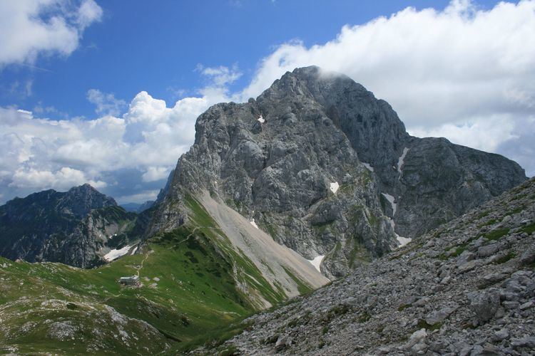
Planjava (2,394 m) is the highest mountain of the eastern Kamnik Alps in northern Slovenia. On the western side there is a steep wall over the Kamniško sedlo pass, on the eastern side runs a long ridge and on the northern side there is an almost 1,000 meters high wall above Logarska dolina.
Contents
- Map of Planjava 1242 Stahovica Slovenia
- History of climbing
- Routes
- South eastern wall
- Western wall
- Northern wall
- References
Map of Planjava, 1242 Stahovica, Slovenia
History of climbing
The first recorded climb was by Franz Hohenwart in 1793 with local a from Kamniška Bistrica although it is speculated that there were local hunters who climbed the mountain before them. Planjava is now one of the most visited peaks in Slovenia.
Routes
South eastern wall
Western wall
Northern wall
References
Planjava Wikipedia(Text) CC BY-SA