
Province Ontario | ||
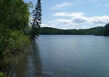 | ||
Kakagi Lake, also known as Crow Lake, is a lake just north of Nestor Falls, Ontario, Canada, in the township of Sioux Narrows-Nestor Falls and right across Highway 71 from Stevens Bay on Lake of the Woods. It is also feeds Lake of the Woods through a series of lakes starting with Cedartree Lake.
Contents
Map of Kakagi Lake, Ontario, Canada
Overview
It is a body of water that is essentially not charted, and caution must be taken when navigating this body of water. Kakagi Lake is approximately 28,000 acres in size, about 15 miles long and up to 7 miles wide. It is 1,108 feet above sea level with an average depth 68 feet and a maximum depth of 180 feet. The lake has many islands such as Gold Point Island, Green Island, Mink Island, Bear-Beaver Island, Alora Island, Mosquito Point Island and Pine Island. There are several spots on the lake frequented by campers as well as several natural recreational areas such as Jumping Rock, Seagull Rock and Soft Sand Beach.
It is well known for its lake trout fishing because of its many spawning reefs throughout the lake and deep water basins equally well distributed. Musky, smallmouth bass, northern pike and lake whitefish also inhabit Kakagi. Kagaki's forage fish include perch, rock bass, cisco, lake shiners and a variety of other minnow species.
There are small number of private cabins mostly on Young's Bay, and several commercial fishing lodges and resorts which offer housekeeping cabins and American plan packages for American and Canadian Tourists. In winter, Kakagi is the gateway to a system of lakes and portages that stretches almost 60 km east of Nestor Falls by snowmobile. Young's Bay is named after Clyde Young who came to Canada from Chicago in 1932 and founder of Crow Lake Camp.
Sabaskong Bay reserve, band 35 lay claim to much of Kakagi Lake. The Lake also has a history of gold mining.
Canoe Route
There is a popular canoe route known as the Kakagi Lake-Cameron Lake canoe route. The loop is considered of moderate difficulty and starts and ends at Kakagi. Native pictographs and bald eagles exist on Stephen Lake. The length is 51 km and typically takes 4 days across 5 portages. The route typically starts at the Government Dock (N49 degrees 12.583 W093 degrees 57.963’), and moves north for 11 km to Emm Bay. Then move north through a narrows and then 1 km until the first portage to Cedartree Lake. The portage is 125 meters (N49 degrees 18.537’ W093 degrees 53.347’). Then follow the west shore of Cedartree Lake into the river and continue the length of the river until the portage to Flint Lake. The portage is 225 meters (N49 degrees 19.631’ W093 degrees 51.897’) and passes over Cameron Lake road. Next follow the rest of the river into Flint Lake and then go to the south shore until the next portage into Stephen Lake via Cameron Creek. The portage is 100 meters and is located on the east side of Cameron Creek. Move east down Stephen Lake via the narrows. The pictographs are found just after the narrows and to the left just around the bay. Move to the east on Stephen Lake into the bay until the portage to Cameron Lake via Cameron Creek. The portage is 400 meters (N49 degrees 17.780’ W093 degrees 45.300’) and follows a small creek to the south of the trail. Next move into Bog Bay through the narrows and into Cameron Lake and then follow the south shore for 7 km to the most southeasterly end of the lake to the portage back into Kakagi Lake. The portage is 2500 meters (N49 degrees 14261’ W093 degrees 41238’). Once on Kakagi Lake, follow the north shore, heading west for about 7 km the continue west back to the Government dock for 12 km.
Book
Although the book is set in Northern Ontario, Crow Lake is not actually about Kakagi (Crow) Lake.