
 | ||
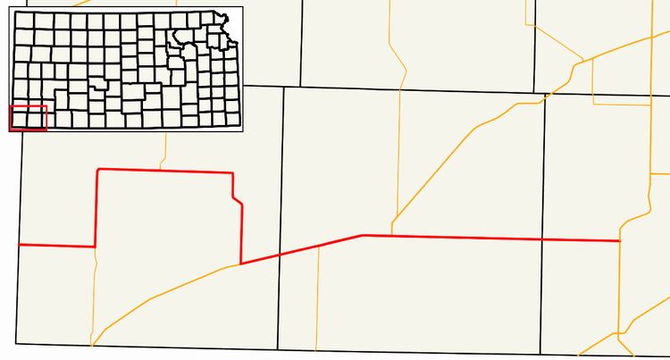
K-51 is a west-east state highway in the southwestern part of the U.S. state of Kansas. It travels through portions of Morton, Stevens, and Seward counties.
Contents
Map of K51, 36160 Dipperz, Germany
Route description
K-51 begins at the Colorado state line, acting as a continuation of County Road M. The highway travels due east through fields. K-51 then turns north onto K-27, forming a 10 mile (16 km) long concurrency. K-27 leaves at Richfield. K-51 runs eastward for a few miles before heading south towards Rolla. In Rolla, US-56 is met, and K-51 turns east onto US-56, crossing into Stevens County. Both routes then pick up northbound K-25, with all three routes heading into Hugoton. In the city itself, US-56 and K-25 turn north, leaving K-51 to head east on its own. The route goes eastward, entering Seward County. K-51 comes to an end north of Liberal at US-83.
History
Until 1983, the portion of K-51 between Hugoton and US-83 was shared with a previous alignment of US-270.