
Country United States County Morton FIPS code 20-59200 Elevation 1,033 m Zip code 67953 Local time Wednesday 6:58 PM | Time zone Central (CST) (UTC-6) GNIS feature ID 0485068 Area 2.59 km² Population 42 (2013) Area code 620 | |
 | ||
Weather 7°C, Wind N at 27 km/h, 82% Humidity | ||
Richfield is a city in Morton County, Kansas, United States. As of the 2010 census, the city population was 43.
Contents
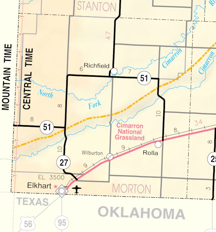
- Map of Richfield KS 67953 USA
- Early history
- 19th century
- 20th century
- Geography
- Climate
- 2010 census
- 2000 census
- References
Map of Richfield, KS 67953, USA
Early history
For many millennia, the Great Plains of North America was inhabited by nomadic Native Americans. From the 16th century to 18th century, the Kingdom of France claimed ownership of large parts of North America. In 1762, after the French and Indian War, France secretly ceded New France to Spain, per the Treaty of Fontainebleau.
19th century
In 1802, Spain returned most of the land to France, but keeping title to about 7,500 square miles. In 1803, most of the land for modern day Kansas was acquired by the United States from France as part of the 828,000 square mile Louisiana Purchase for 2.83 cents per acre. In 1848, after the Mexican-American War, the Treaty of Guadalupe Hidalgo with Spain brought into the United States all or part of land for ten future states, including southwest Kansas.
In 1854, the Kansas Territory was organized, then in 1861 Kansas became the 34th U.S. state.
Richfield was platted in 1885. It was named for the fertility of their land. The town was built up quickly: in less than one year, Richfield had 600 inhabitants. In 1886, Morton County was founded and Richfield was established as the county seat.
20th century
By 1900, its population had declined to 61.
In the 1930s, the prosperity of the area was severely affected by its location within the Dust Bowl. This catastrophe intensified the economic impact of the Great Depression in the region.
In 1961, the county seat was moved from Richfield to Elkhart.
Geography
Richfield is located at 37°15′57″N 101°47′1″W (37.265731, -101.783654). According to the United States Census Bureau, the city has a total area of 1.00 square mile (2.59 km2), all of it land.
Climate
According to the Köppen Climate Classification system, Richfield has a semi-arid climate, abbreviated "BSk" on climate maps.
2010 census
As of the census of 2010, there were 43 people, 20 households, and 15 families residing in the city. The population density was 43.0 inhabitants per square mile (16.6/km2). There were 25 housing units at an average density of 25.0 per square mile (9.7/km2). The racial makeup of the city was 100.0% White.
There were 20 households of which 25.0% had children under the age of 18 living with them, 70.0% were married couples living together, 5.0% had a female householder with no husband present, and 25.0% were non-families. 25.0% of all households were made up of individuals and 10% had someone living alone who was 65 years of age or older. The average household size was 2.15 and the average family size was 2.53.
The median age in the city was 50.5 years. 16.3% of residents were under the age of 18; 7% were between the ages of 18 and 24; 25.6% were from 25 to 44; 18.7% were from 45 to 64; and 32.6% were 65 years of age or older. The gender makeup of the city was 44.2% male and 55.8% female.
2000 census
As of the census of 2000, there were 48 people, 25 households, and 14 families residing in the city. The population density was 48.1 people per square mile (18.5/km²). There were 26 housing units at an average density of 26.1 per square mile (10.0/km²). The racial makeup of the city was 100.00% White.
There were 25 households out of which 20.0% had children under the age of 18 living with them, 52.0% were married couples living together, 4.0% had a female householder with no husband present, and 44.0% were non-families. 40.0% of all households were made up of individuals and 28.0% had someone living alone who was 65 years of age or older. The average household size was 1.92 and the average family size was 2.57.
In the city, the population was spread out with 16.7% under the age of 18, 4.2% from 18 to 24, 22.9% from 25 to 44, 33.3% from 45 to 64, and 22.9% who were 65 years of age or older. The median age was 52 years. For every 100 females there were 84.6 males. For every 100 females age 18 and over, there were 81.8 males.
The median income for a household in the city was $37,813, and the median income for a family was $42,500. Males had a median income of $33,750 versus $12,083 for females. The per capita income for the city was $16,974. There were no families and 10.3% of the population living below the poverty line, including no under eighteens and none of those over 64.