
Area 1,883 km² Unemployment rate 3.9% (Apr 2015) | Website StevensCoKS.org Founded 3 August 1886 Population 5,816 (2013) Largest city Hugoton | |
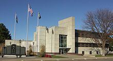 | ||
Stevens County (standard abbreviation: SV) is a county located in the U.S. state of Kansas. As of the 2010 census, the county population was 5,724. Its county seat is Hugoton. The county is named for the Reconstruction era Pennsylvania politician Thaddeus Stevens.
Contents
- Map of Stevens County KS USA
- 19th century
- Geography
- Major highways
- Adjacent counties
- National protected area
- Demographics
- County Government
- Unified school districts
- Cities
- Unincorporated community
- Townships
- References
Map of Stevens County, KS, USA
19th century
On July 25, 1888, the Hay Meadow Massacre was a violent county seat fight between groups from Hugoton and Woodsdale, where 4 men were murdered.
Geography
According to the U.S. Census Bureau, the county has a total area of 727 square miles (1,880 km2), of which 727 square miles (1,880 km2) is land and 0.2 square miles (0.52 km2) (0.02%) is water.
Major highways
Adjacent counties
National protected area
Demographics
As of the census of 2000, there were 5,463 people, 1,988 households, and 1,457 families residing in the county. The population density was 8 people per square mile (3/km²). There were 2,265 housing units at an average density of 3 per square mile (1/km²). The racial makeup of the county was 83.01% White, 0.93% Black or African American, 0.93% Native American, 0.24% Asian, 0.02% Pacific Islander, 13.25% from other races, and 1.61% from two or more races. 21.73% of the population were Hispanic or Latino of any race.
There were 1,988 households out of which 38.80% had children under the age of 18 living with them, 63.10% were married couples living together, 7.10% had a female householder with no husband present, and 26.70% were non-families. 24.30% of all households were made up of individuals and 12.10% had someone living alone who was 65 years of age or older. The average household size was 2.72 and the average family size was 3.27.
In the county, the population was spread out with 31.20% under the age of 18, 8.30% from 18 to 24, 27.80% from 25 to 44, 19.40% from 45 to 64, and 13.30% who were 65 years of age or older. The median age was 34 years. For every 100 females there were 95.30 males. For every 100 females age 18 and over, there were 92.50 males.
The median income for a household in the county was $41,830, and the median income for a family was $49,063. Males had a median income of $36,525 versus $22,803 for females. The per capita income for the county was $17,814. About 8.30% of families and 10.30% of the population were below the poverty line, including 15.10% of those under age 18 and 4.70% of those age 65 or over.
County Government
Stevens County is governed by the Stevens County Commissioners. The current members are David Bozone, Joe D. Thompson, and Pat Hall. They are elected from their respected districts, every Four years with one district up for election during midterms.
Unified school districts
Cities
Unincorporated community
Townships
Stevens County is divided into six townships. None of the cities within the county are considered governmentally independent, and all figures for the townships include those of the cities. In the following table, the population center is the largest city (or cities) included in that township's population total, if it is of a significant size.