
Length 120.7 km | ||
 | ||
Counties | ||
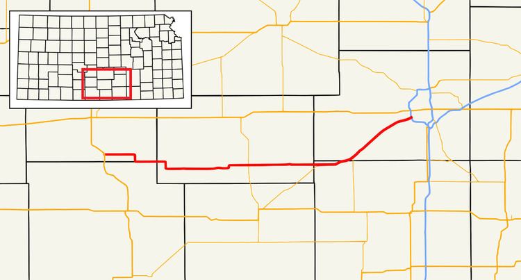
K-42 is a 75-mile (120.799 km) state highway in the U.S. state of Kansas. The highway serves as a connection to Wichita for communities between the US-160 and US-54 corridors.
Contents
Map of SW Blvd, Wichita, KS 67227, USA
Route description
It begins at US-281 in Sawyer and travels southeast to Isabel where it rides the Barber/Pratt county line until it enters Kingman County, where it passes through Nashville, Zenda, and Spivey. North of Rago it intersects K-14 then continues on to pass through Norwich.
After entering Sedgwick County, it passes through Viola where K-49's northern terminus is. It continues northeast into south Wichita and terminates at Exit 5 on I-235.
History
K-42 once terminated at US-54 and US-400. The route was truncated to I-235 around 2003, when it was removed from the official Kansas map.
References
K-42 (Kansas highway) Wikipedia(Text) CC BY-SA