
Country United States Time zone CST (UTC-6) Elevation 197 m Local time Monday 11:47 PM | Established November 6, 1849 ZIP codes 61427, 61432, 61520 Area 92.02 km² Population 510 (2010) | |
 | ||
Weather -3°C, Wind N at 13 km/h, 92% Humidity | ||
Joshua Township is one of twenty-six townships in Fulton County, Illinois, USA. As of the 2010 census, its population was 510 and it contained 206 housing units.
Contents
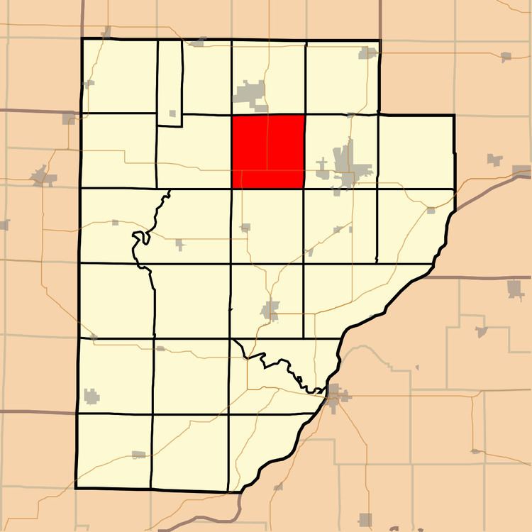
- Map of Joshua Township IL USA
- Geography
- Unincorporated towns
- Cemeteries
- Major highways
- School districts
- Political districts
- References
Map of Joshua Township, IL, USA
Geography
According to the 2010 census, the township has a total area of 35.53 square miles (92.0 km2), of which 34.83 square miles (90.2 km2) (or 98.03%) is land and 0.7 square miles (1.8 km2) (or 1.97%) is water.
Unincorporated towns
(This list is based on USGS data and may include former settlements.)
Cemeteries
The township contains these cemeteries: Bybee, Fiatt, Gardiner, Locust Lane and Moore.
Major highways
School districts
Political districts
References
Joshua Township, Fulton County, Illinois Wikipedia(Text) CC BY-SA