
District Kurnool Time zone IST (UTC+5:30) Area code 08523 | Talukas Alur PIN 518347 | |
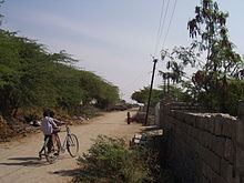 | ||
Joharapuram is a village located in Aspari mandal in Kurnool district of Andhra Pradesh, India.
Contents
Map of Joharapuram, Andhra Pradesh 518347
Geography
Joharapuram village has population around 5250. Most of the people depend on agriculture. Literacy rate is around 55%. The village has some of the oldest temples in the Alur taluk. These temples were built in 16-17th century.
Near by villages are Devanabanda ( 4.7 km ), Pedda Hulthi ( 5.2 km ), Chiramandoddi ( 5.6 km ), Chinnahulthi ( 6.2 km ), Nalakadoddi ( 7.3 km ), Hosur ( 7.5 km ), Aspari ( 7.6 km ), Molagavalli ( 9.3 km ), Burujula ( 9.6 km ).
Agriculture
The main crops are jowar or sorghum, [[Bengal gram ]], groundnuts, cotton, chickpeas etc. The lands are very fertile and are rain fed.
Education
Z.P.High School is the main school for the children of Joharapuram village and the surrounding villages. Some of the students of this school end up graduating from some of the premiere institutes in India & abroad.
They are two primary schools along with a Government hostel. Many students from the surrounding villages stay in the hostel to complete their higher education.