
Area 150 ha | Founded 1963 Local time Saturday 11:09 PM | |
 | ||
Name meaning The bridge over the River Zerka Weather 15°C, Wind SE at 13 km/h, 60% Humidity | ||
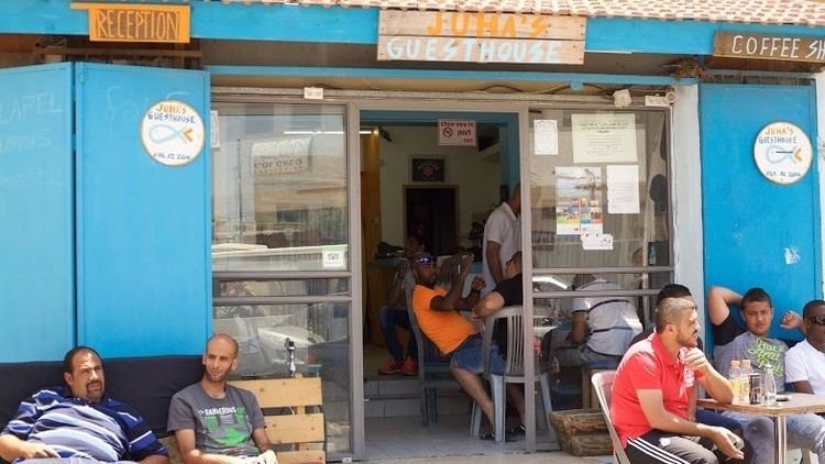
Diy travel reviews ilh juha s guesthouse zarqa bay jisr az zarqa near caesarea
Jisr az-Zarqa (Arabic: جِسْر الزَّرْقَاء, Hebrew: גִ'סְּר א-זַּרְקָא lit. bridge over the blue; often shortened as Jisr) is an Israeli Arab town on Israel's northern Mediterranean coastal plain. Located just north of Caesarea within the Haifa District, it achieved local council status in 1963. According to the Central Bureau of Statistics (CBS) the town had a population of 13,689 in 2014, living on 1,500 dunams (1.5 km2) of coastal land. 80% of residents reportedly live below the poverty line. The name Jisr az-Zarqa is a reference to Taninim Stream, which is known in Arabic as the "Blue Valley" (Wadi az-Zarka). The mayor is Az-Adin Amash. Jisr az-Zarqa is the only remaining Arab town in Israel located on the coast of the Mediterranean Sea.
Contents
- Diy travel reviews ilh juha s guesthouse zarqa bay jisr az zarqa near caesarea
- Map of Jisr az Zarqa Israel
- History
- Ottoman era
- British Mandate era
- 1948 aftermath
- Demographics
- Culture
- References
Map of Jisr az-Zarqa, Israel
History
Excavations have revealed walls with pottery remains dating from the 1st CE, with amphoras dating from the 4th to 7th CE, and remains of a structure carrying a ceramic pipe, most probably dating to the Byzantine era. It has been suggested that the aqueduct in Jisr az-Zarqa is part of the aqueduct ending in Caesarea Maritima, but was never completed.
Ottoman era
In 1882, the Palestine Exploration Fund's Survey of Western Palestine (SWP) described it: “This is properly speaking a dam rather than a bridge, built across the river so as to form a large pool. There is a causeway on the top of the dam: the height on the west is 20 feet; on the east the level of the water was 3 feet below the roadway. The masonry resembles that of the aqueduct fed from the pool. [..] The eastern face of the dam is cemented. Sluices lined with cement are constructed in the dam. The roadway is 8 feet to 10 feet broad. The work appears to be Roman."
British Mandate era
In the 1922 census of Palestine conducted by the British Mandate authorities, ‘’Jisr al Zarqa’’ showed a population of 348 Muslims, increasing in the 1931 census (when it was counted with Kabara) to 572 Muslims, in a total of 117 houses.
In 1945 the population of Arab el Ghawarina (Jisr Zerqa) was 620, all Muslims, while the total land area was 3,428 dunams, according to an official land and population survey. Of this, 6 were plantations and irrigable land, 674 for cereals, while 69 dunams were classified as built-up areas.
1948, aftermath
Before the establishment of the state, it was inhabited by Bedouin of the Ghawarina tribe. The intervention of Jews from the neighboring towns of Zikhron Ya'akov and Binyamina, who relied on the population of Jisr az-Zarqa for agricultural labor, prevented the dispersal of its population in 1948.
In November 2002, the Caesarea Development Corporation constructed a large earthen embankment running the length of the 160 meter-wide corridor between Jisr az-Zarqa and neighboring Caesarea. The embankment was built to block noise from the muezzin in local mosques, celebratory gunfire, and to reduce property crime in surrounding communities. Residents of Jisr az-Zarqa claim that the national park in the north, the embankment to the south, the highway to the east and the sea to the west, are keeping the town from expanding.
The main coastal highway was built without providing an access to the village. However, a new interchange to Jisr az-Zarqa is being planned. The municipality of Jisr az-Zarka is seeking to promote environmental tourism to the town and its beachfront. The Israel National Trail, a cross-country trail that runs from Dan in the north to Eilat in the south, passes through Jisr az-Zarka. In 2013 it was reported that there were efforts to turn the town into a tourist destination
In 2011, a women's leadership program was established in the wake of a similar project in the nearby town of Fureidis, to encourage women's participation in political and public leadership positions.
Problems of pollution and overfishing in the coastal waters have affected the local economy, and many now work inland. From 20 to 30 buses transport on a daily basis Jisr az-Zarq residents to jobs, mostly menial, in Haifa, Tel Aviv and elsewhere.
Demographics
The inhabitants of Jisr az-Zarqa are primarily Muslim.
In 2006, the town reportedly had the lowest average monthly wage in Israel. According to the Israel Central Bureau of Statistics, it also had the highest high school drop out rates in the country, at 12%.
A local resident, Mariam Amash, applied for a new identity card in Hadera in February 2008, using a birth document issued by the Ottoman Empire showing she was born in 1888. If verified by the Guinness Book of World Records, this would have made her the oldest living person in the world at 120. She died on December 22, 2012 at the age of 124.
In 1998, the first multiple kidney transplant in Israel took place between a couple from Jisr az-Zarqa and a Jewish couple from Jerusalem.
Culture
The film Al Jiser (2004) by Ibtisam Mara'ana examines the lives of residents of Jisr-az Zarka.