
- elevation 4,500 m (14,764 ft) Length 2,290 km | - elevation 300 m (984 ft) Discharge 4,471 m³/s | |
 | ||
Bridges Jinshajiang Bridge, Bingcaogang Bridge, Zhongba Bridge, Taku Bridge | ||
New bridge to benefit people along china s jinsha river
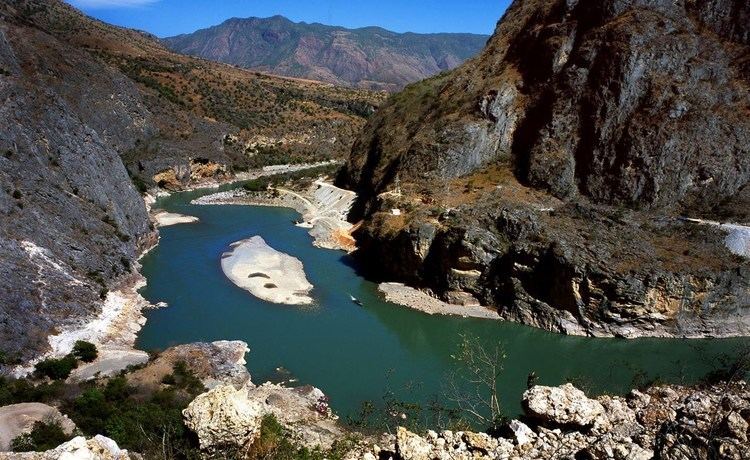
The Jinsha River (Chinese: 金沙江, Jīnshājiāng, "Gold Dust River") is the Chinese name for the upper stretches of the Yangtze River. It flows through the provinces of Qinghai, Sichuan, and Yunnan in western China. The river passes through Tiger Leaping Gorge.
Contents
- New bridge to benefit people along china s jinsha river
- Map of Jinsha River China
- Name
- Route
- Gradients
- Dams
- Imperial China
- Peoples Republic
- References
Map of Jinsha River, China
It is sometimes grouped together with the Lancang (upper Mekong) and Nu (upper Salween) as the Sanjiang ("Three Rivers") area, part of which makes up the Three Parallel Rivers of Yunnan Protected Areas.
New bridge to benefit people along china s jinsha river
Name
The river was first recorded as the Hei (黑水, Hēishuǐ, lit. "Blackwater") in the Warring States' "Tribute of Yu". It was described as the Sheng (t 繩水, s 绳水, Shéngshuǐ, "Rope River") in the Han-era Classic of Mountains and Seas. During the Three Kingdoms, it was known as the Lu (t 瀘水, s 泸水, Lúshuǐ). The present name was adopted in during the Song dynasty.
Owing to earlier romanization systems, the river has been known as the Chin-sha Chiang and Kinsha Kiang (when it was not simply described as the Yangtze) in English sources for the last three centuries. The most common present name, Jinsha is the Hanyu Pinyin romanization of the same Chinese characters as the other two.
Although the name is generally over-literally translated as the "Gold Sand" or "Golden-Sanded River", the name is not poetic or descriptive of the color of the river's banks. Rather, 金沙 described actual placer gold, alluvial gold powder sometimes still panned from the river's waters.
The Jinsha culture in prehistoric China derives its name from a road near its type site and not from the river directly.
Route
The Jinsha River is simply the upper course of the Yangtze, although the Yalong and Min rivers were sometimes considered to have been the main course before the advent of modern geography. It is traditionally considered to begin at the confluence of the Tongtian and Batang rivers near Gyêgu in Qinghai.
As the Jinsha River, it then flows south through a deep gorge parallel to the similar gorges of the upper Mekong and upper Salween rivers, from which it is separated by the Ningjing Mountains. It forms the western border of Sichuan for some 250 miles (400 km) and then flows into Yunnan province. After a large, 200 mile (320 km) long loop to the north of Dali Bai Autonomous Prefecture, the Jinsha swings northeast, forming the Sichuan-Yunnan provincial boundary until it joins the Min River at Yibin in Sichuan to form the Yangtze.
Gradients
The upper course of the river falls about 14 feet per mile (2.7 m/km). Below Batang in Sichuan, the gradient gradually decreases to about 8 feet per mile (1.5 m/km) but the Jinsha is not navigable. Its upper course through the gorges, particularly, is more of an obstacle than an aid to transportation.
Dams
The Jinsha is being heavily developed, primarily for hydroelectric power. As of March 2014, a total of 25 dams are completed, under construction or planned for the river. Those dams are listed below from downstream to upstream.
Imperial China
The pre-imperial "Tribute of Yu" recorded the traditional view of the Yangtze River as originating with the Min or Yalong instead of the Jinsha and this remained unchallenged for millennia, even after Li Daoyuan's Commentary on the Water Classic recorded much of the Jinsha's extensive river system during the Northern Wei. The Ming-era geographer Xu Xiake was the first to correct this, although it remained a common misconception in China as late as the early 20th century.
People's Republic
The Jinsha River is under heavy development by China, with over sixteen dam projects in various phases of development along the river, and many on its tributaries as well, especially the Yalong. Four dams along the lower part of the river are under construction or have already been completed to generate hydroelectric power and to trap silt that would otherwise create problems at the Three Gorges Dam. The ten largest dams will produce 55,710 megawatts of power.