
Country India Assembly constituency Joypur Elevation 297 m Population 148,156 (2011) | Time zone IST (UTC+5.30) Area 256.6 km² Area code 03254 | |
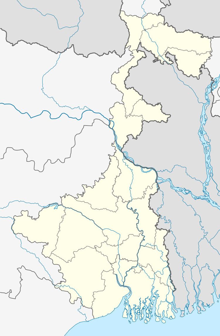 | ||
Jhalda II is a community development block that forms an administrative division in Purulia Sadar West subdivision of Purulia district in the Indian state of West Bengal.
Contents
Background
The Jaina Bhagavati-Sutra of 5th century AD mentions that Purulia was one of the sixteen mahajanapadas and was a part of the kingdom known as Vajra-bhumi in ancient times. In 1833, Manbhum district was carved out of Jungle Mahals district, with headquarters at Manbazar. In 1838, the headquarters was transferred to Purulia. In 1956, Manbhum district was partitioned between Bihar and West Bengal under the States Reorganization Act and the Bihar and West Bengal (Transfer of Territories) Act 1956.
Red corridor
106 districts spanning 10 states across India, described as being part of the Left Wing Extremism activities, constitutes the Red corridor. In West Bengal the districts of Paschim Medinipur, Bankura, Purulia and Birbhum are part of the Red corridor. However, as of July 2016, there had been no reported incidents of Maoist related activities from these districts for the previous 4 years.
The CPI (Maoist) extremism affected CD Blocks in Purulia district were: Jhalda I, Jhalda II, Arsha, Baghmundi, Balarampur, Barabazar, Manbazar II and Bandwan. Certain reports also included Manbazar I and Joypur CD Blocks and some times indicted the whole of Purulia district.
The Lalgarh movement, which started attracting attention after the failed assassination attempt on Buddhadeb Bhattacharjee, then chief minister of West Bengal, in the Salboni area of Paschim Medinipur district, on 2 November 2008 and the police action that followed, had also spread over to these areas. The movement was not just a political struggle but an armed struggle that concurrently took the look of a social struggle. A large number of CPI (M) activists were killed. Although the epi-centre of the movement was Lalgarh, it was spread across 19 police stations in three adjoining districts – Paschim Medinipur, Bankura and Purulia, all thickly forested and near the border with Jharkhand. The deployment of CRPF and other forces started on 11 June 2009. The movement came to an end after the 2011 state assembly elections and change of government in West Bengal. The death of Kishenji, the Maoist commander, on 24 November 2011 was the last major landmark.
Geography
Kotshila is located at 23°24′58″N 86°05′40″E.
Jhalda II CD Block is located in the western part of the district. The Kangsabati River takes its name after the confluence of the Saharjor and Girgiri rivers near Tigra village in Jhalda II CD Block. Geographyically the area forms a part of the Chota Nagpur Plateau.
Jhalda II CD Block is bounded by Jaridih CD Block, in Bokaro district of Jharkhand, on a part of the north, Joypur on parts of the north and the east, Arsha CD Block on the east, Baghmundi CD Block on the south, and Jhalda I CD Block on the west.
It is located 45 km from Purulia, the district headquarters.
Jhalda II CD Block has an area of 256.61 km2. It has 1 panchayat samity, 9 gram panchayats, 99 gram sansads (village councils), 131 mouzas, 118 inhabited villages and 2 census towns. Kotshila and Jhalda (partly) police stations serve this block. Headquarters of this CD Block is at Kotshila.
Gram panchayats of Jhalda II block/panchayat samiti are: Bamina-Belyadih, Begunkodar, Chekya, Chitmu, Hirapur-Adardih, Majhidih, Nowahatu, Rigid and Tatuara.
Population
As per the 2011 Census of India Jhalda II CD Block had a total population of 148,156, of which 135,814 were rural and 12,342 were urban. There were 75,453 (51%) males and 72,703 (49%) females. Population below 6 years was 24,831. Scheduled Castes numbered 15,663 (10.57%) and Scheduled Tribes numbered 15,917 (10.74%).
As per 2001 census, Jhalda II block had a total population of 123,696, out of which 63,279 were males and 60,417 were females. Jhalda II block registered a population growth of 18.15 per cent during the 1991-2001 decade. Decadal growth for Purulia district was 13.96 per cent. Decadal growth in West Bengal was 17.84 per cent.
Census Towns in Jhalda II CD Block are (2011 census figures in brackets): Chekya (5,995) and Begun Kodar (6,347).
Large villages (with 4,000+ population) in Jhalda II CD Block are (2011 census figures in brackets): Belyadi (4,217), Bararola (5,913) and Tatayara (5,863).
Other villages in Jhalda II CD Block are (2011 census figures in brackets): Chitmu (3,893), Adardi (1,980), Bamaniya (2,785), Kotshila (1,452), Hirapur (739), Nawahatu (1,625) and Rigid (2,312).
Literacy
As per the 2011 census the total number of literates in Jhalda II CD Block was 67,532 (54.76% of the population over 6 years) out of which males numbered 45,588 (72.53% of the male population over 6 years) and females numbered 21,944 (36.29%) of the female population over 6 years). The gender disparity (the difference between female and male literacy rates) was 36.24%.
See also – List of West Bengal districts ranked by literacy rate
Languages and religions
Bengali is the local language in these areas.
Along the western borders of the district the local Bengali dialect spoken in the area often merges with Magahi dialects such as Kurmali, Khotta and Khottahi or even Khotta Bangla. There is a tribal presence in many of the CD Blocks of the district. Santali was spoken by around 14% of the population of the earlier Manbhum district. Some people also speak Mundari or Kolarian languages such as Kurmali, Mundari and the languages of the Bhumij or Mahli.
In the 2011 census Hindus numbered 129,187 and formed 87.19% of the population in Jhalda II CD Block. Muslims numbered 6,559 and formed 4.43% of the population. Christians numbered 247 and formed 0.17% of the population. Others numbered 12,163 and formed 8.21% of the population. Others include Addi Bassi, Marang Boro, Santal, Saranath, Sari Dharma, Sarna, Alchchi, Bidin, Sant, Saevdharm, Seran, Saran, Sarin, Kheria, and other religious communities.
Infrastructure
121 mouzas in Jhalda II CD Block were electrified by 31 March 2014.
Agriculture
In 2013-14, persons engaged in agriculture in Jhalda II CD Block could be classified as follows: bargadars 0.44%, patta (document) holders 14.55%, small farmers (possessing land between 1 and 2 hectares) 6.12%, marginal farmers (possessing land up to 1 hectare) 38.42% and agricultural labourers 40.47%.
In 2013-14, the total area irrigated in Jhalda II CD Block was 11,856.90 hectares, out of which 3,832.00 hectares was by canal irrigation, 7,228.65 hectares by tank water, 42.21 hectares by river lift irrigation, 201.80 hectares by open dug wells and 552.20 hectares by other means.
In 2013-14, Jhalda II CD Block produced 85,194 tonnes of Aman paddy, the main winter crop, from 34,155 hectares, 511 tonnes of wheat from 216 hectares, 158 tonnes of maize from 73 hectares and 1,149 tonnes of potato from 42 hectares. It also produced maskalai, khesari, gram and mustard.
Banking
In 2013-14, Jhalda II CD Block had offices of 4 commercial banks and 1 gramin bank.
Transport
In 2013-14, Jhalda II CD Block had 5 originating/ terminating bus routes.
The NSC Bose Gomoh-Hatia line of South Eastern Railway passes through this CD Block and there are stations at Kotshila and Jhalda. The Purulia-Kotshila branch line connects to the NSC Bose Gomoh-Hatia line at Kotshila.
SH 4 originates from Jhalda at its junction with SH 4A running from Tulin to Chas Morh (both in Purulia district).
Education
In 2013-14, Jhalda II CD Block had 116 primary schools with 15,188 students, 11 middle schools with 453 students and 11 higher secondary schools with 14,085 students. Jhalda II CD Block had 1 general college with 213 students and 215 institutions with 10,696 students for special and non-formal education.
Healthcare
In 2014, Jhalda II CD Block had 1 rural hospital and 2 primary health centres, with total 44 beds and 7 doctors. 7,072 patients were treated indoor and 238,003 patients were treated outdoor in the hospitals, health centres and subcentres of the CD Block.