Kalpana Kalpana (Editor)

Japan National Route 7

Updated on
Edit
Like
Comment
Share on FacebookTweet on TwitterShare on LinkedInShare on Reddit
Length
  
475.5 km

Japan National Route 7

Highway system
  
National highways of Japan

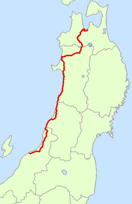
National Route 7 is an important highway on the Sea of Japan side of the island of Honshū, Japan. It links the prefectural capitals of Niigata, Akita, and Aomori.

Contents

Map of Japan, %E5%9B%BD%E9%81%937%E5%8F%B7%E7%B7%9A

Route Data

  • Length: 475.5 km (295.5 mi)
  • Origin: Chuo-ku, Niigata (originates at junction with Routes 8, 17, 49, 113 and 116)
  • Terminus: Aomori (ends at Junction with Routes 4 and 45)
  • Major cities: Shibata, Murakami, Tsuruoka, Sakata, Yurihonjo, Akita, Noshiro, Odate, Hirosaki
  • History

    Route 7 traces about the same route as parts of the Edo period's Ushū Hama Kaidō and Ushū Kaidō.

  • 1952-12-04 - First Class National Highway 7 (from Niigata to Aomori)
  • 1965-04-01 - General National Highway 7 (from Niigata to Aomori)
  • Intersecting routes

  • in Niigata Prefecture
  • Routes 8, 49, 113, 116, 290, 345 and 460
  • in Yamagata Prefecture
  • Routes 47, 112, 344 and 345
  • in Akita Prefecture
  • Routes 13, 101, 103, 105, 285 and 341
  • in Aomori Prefecture
  • Routes 4, 101, 102, 280, 282, 339 and 454
  • References

    Japan National Route 7 Wikipedia