Trisha Shetty (Editor)

Japan National Route 33

Updated on
Edit
Like
Comment
Share on FacebookTweet on TwitterShare on LinkedInShare on Reddit
Length
  
122.9 km

Major cities
  
Kumakogen, Sakawa, Kōchi

Japan National Route 33

Highway system
  
National highways of Japan

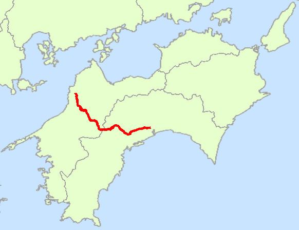
National Route 33 (国道33号, Kokudō Sanjūsan-gō), also known as the Tosa Kaidō, is a Japanese highway on the island of Shikoku. It originates at the intersection of Route 32 and other arteries in the city of Kōchi (capital of Kōchi Prefecture) and terminates in the city of Matsuyama (capital of Ehime Prefecture), where it meets Route 11 and other national highways. Its history dates to the year 662.

Contents

Map of Japan, %E5%9B%BD%E9%81%9333%E5%8F%B7%E7%B7%9A

Route Data

  • Length: 122.9 km (76.4 mi)
  • Origin: Kōchi (originates at the terminus of Routes 32 and 55 and the origin of Routes 55, 194, 195, 197 and 493)
  • Terminus: Matsuyama (ends at the terminus of Routes 11 and 56)
  • Major cities: Niyodogawa, Kumakōgen
  • History

  • 1952-12-04 - First Class National Highway 33 (from Kōchi to Matsuyama)
  • 1965-04-01 - General National Highway 33 (from Kōchi to Matsuyama)
  • References

    Japan National Route 33 Wikipedia


    Similar Topics